
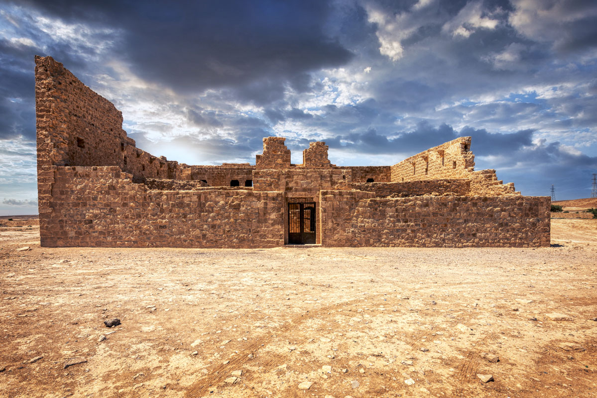
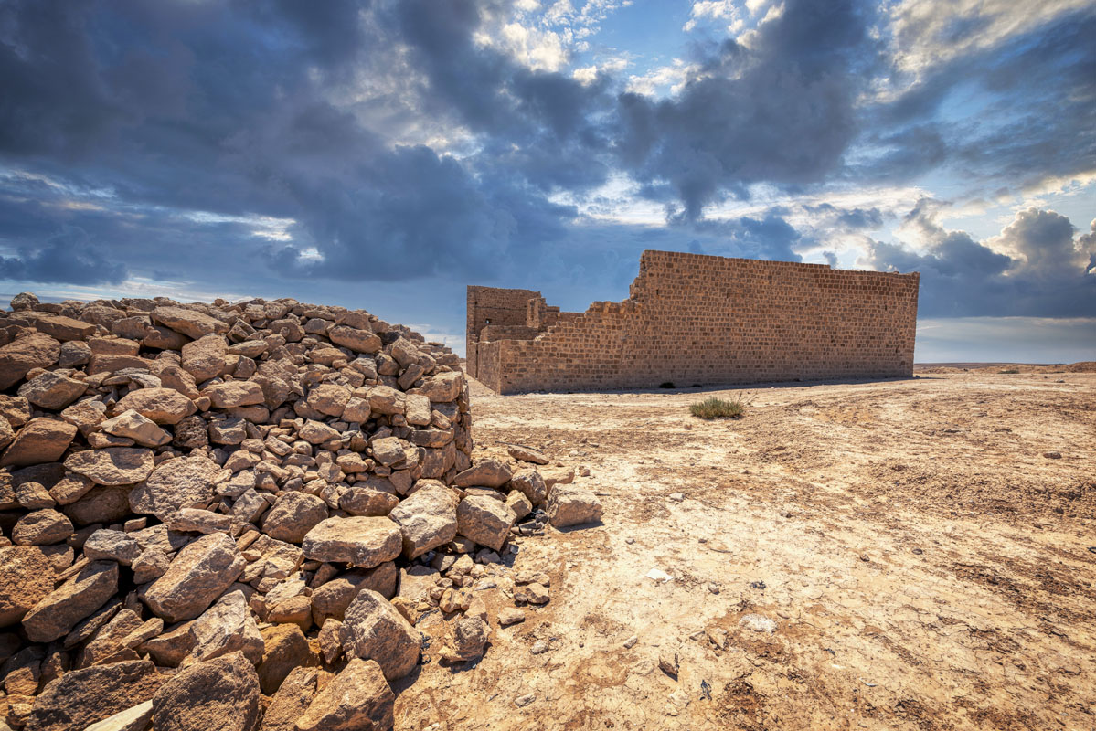
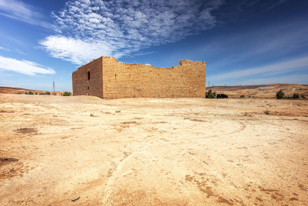
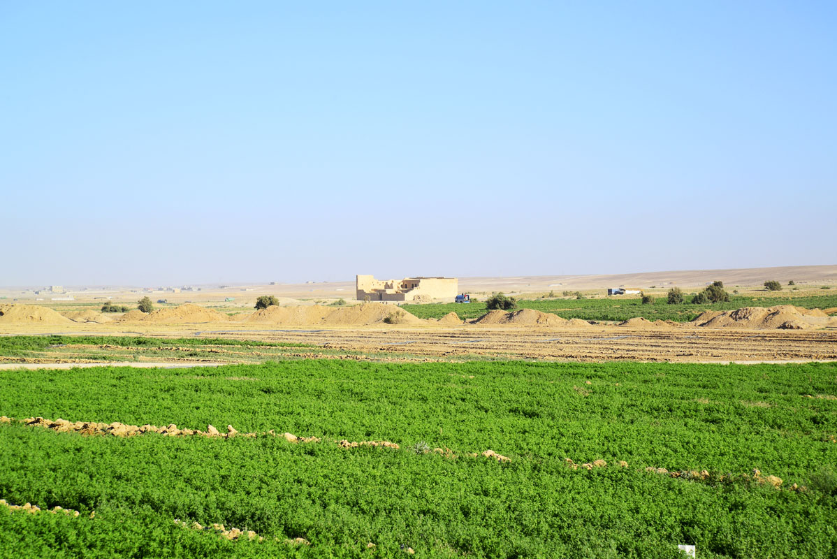
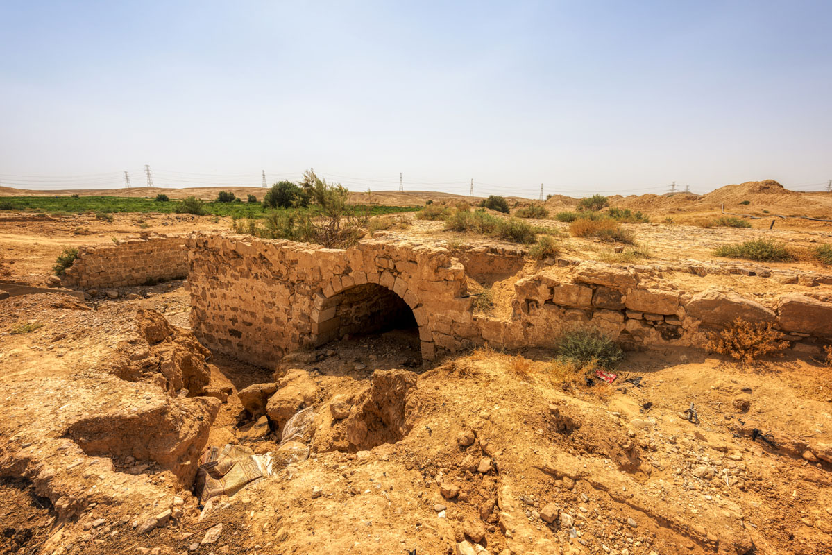
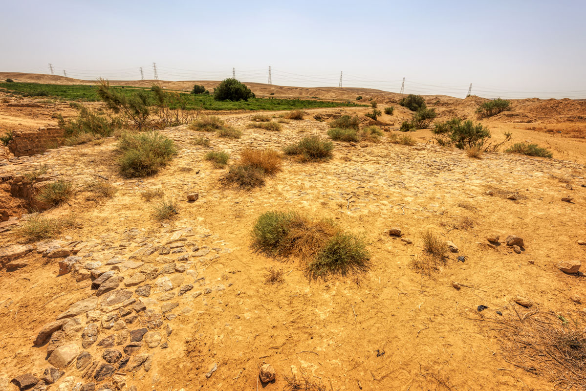
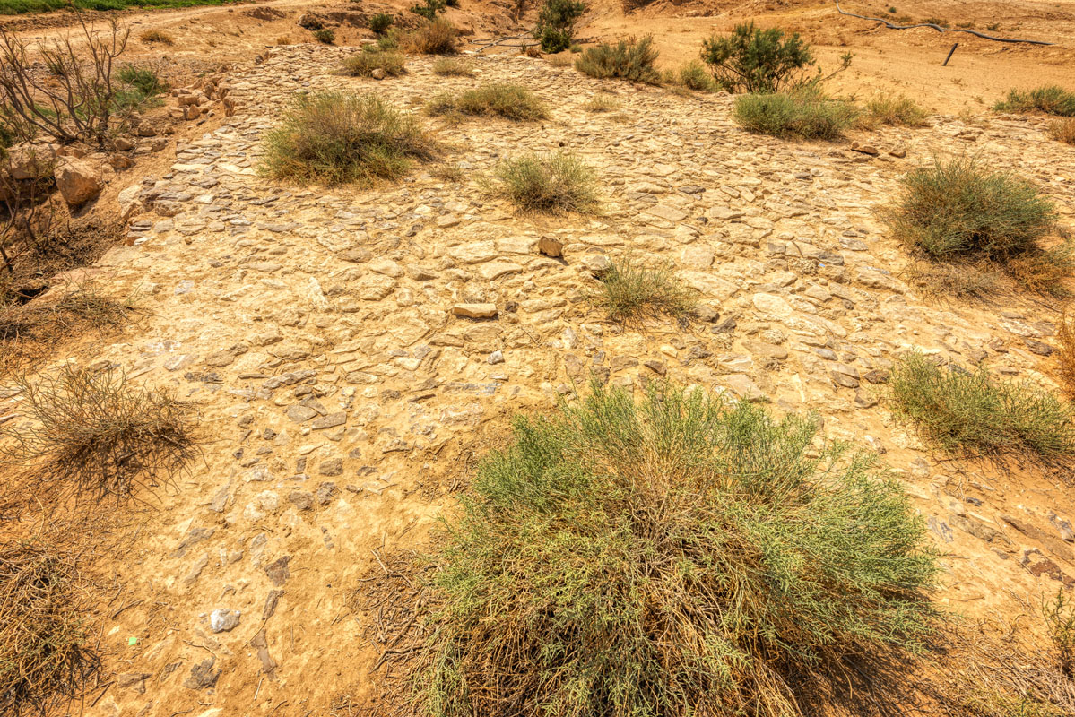
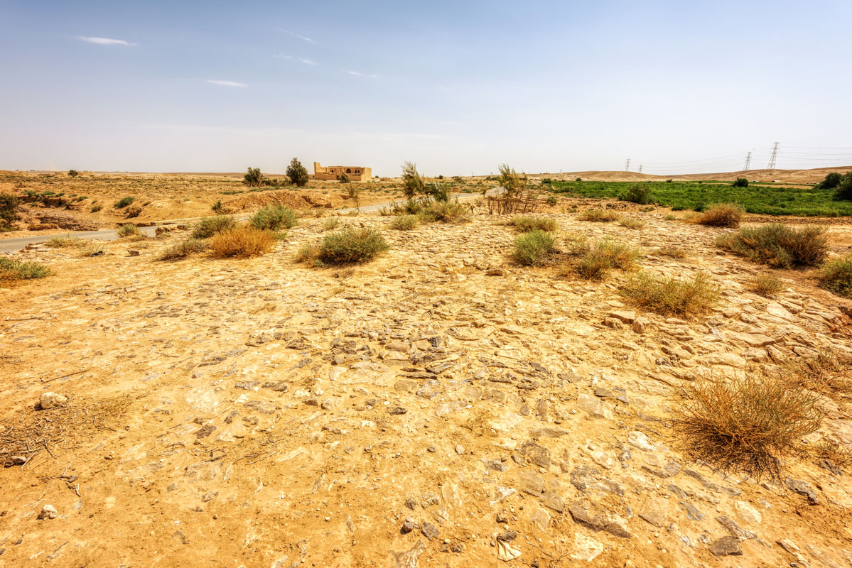
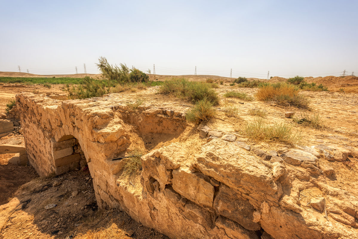
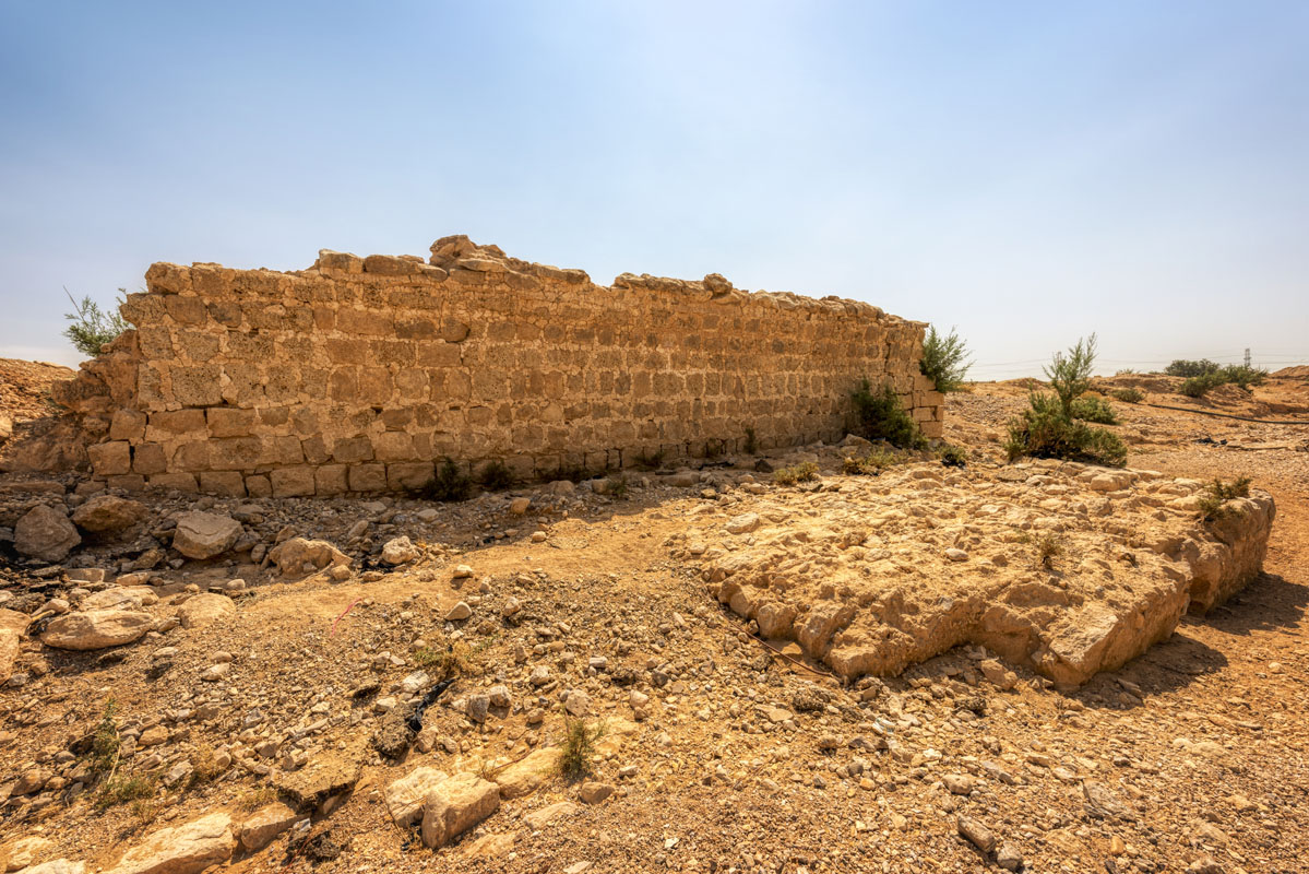
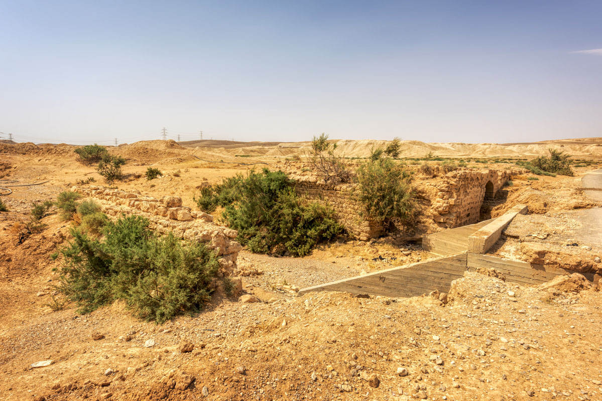
Qat’al Al-Hasa is located 5 km northwest of Hejaz Railway Station. The site lies on the south bank of the main bed of the Wadi al-Hasa and comprises of a large square fort, a small square reservoir, a section of paved road and a bridge across the Wadi al-Hasa. The bridge was built sometime between 1730 and 1733, followed 30 years later, in 1760, by the construction of the fort.
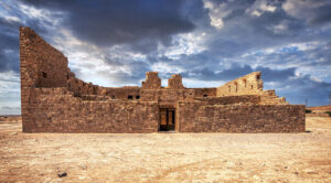
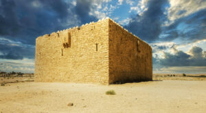
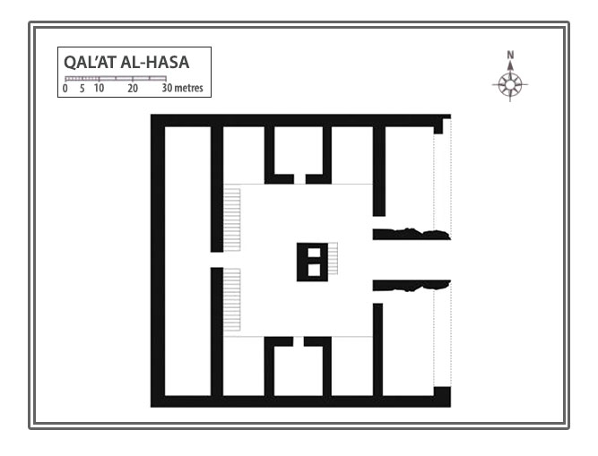
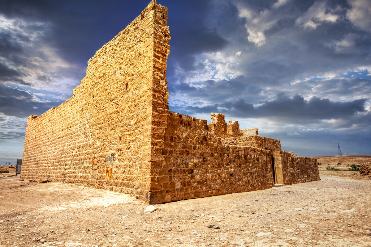
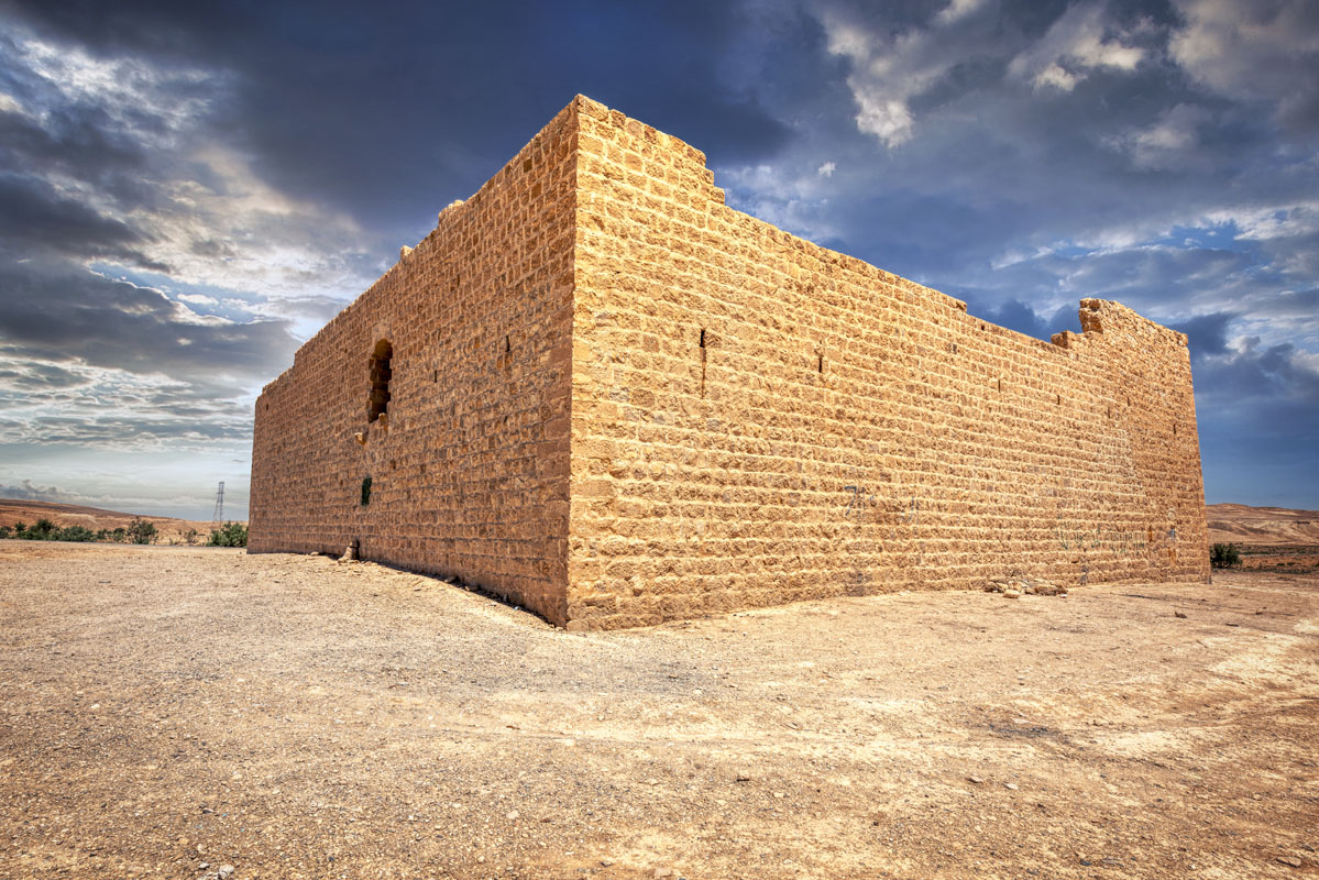
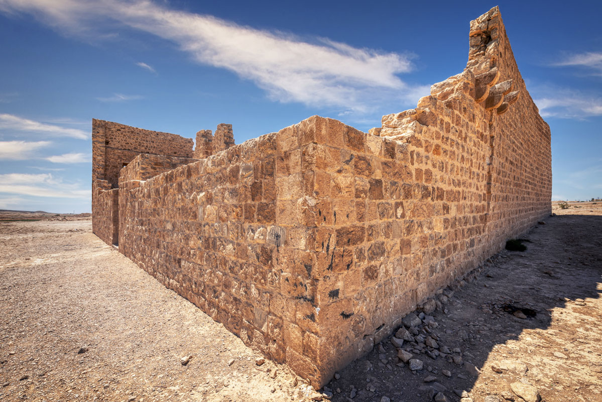
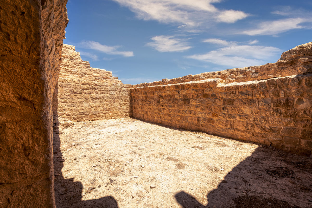
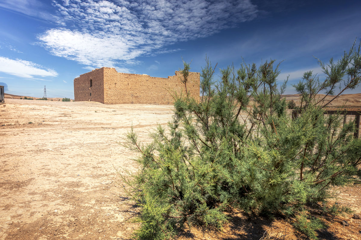
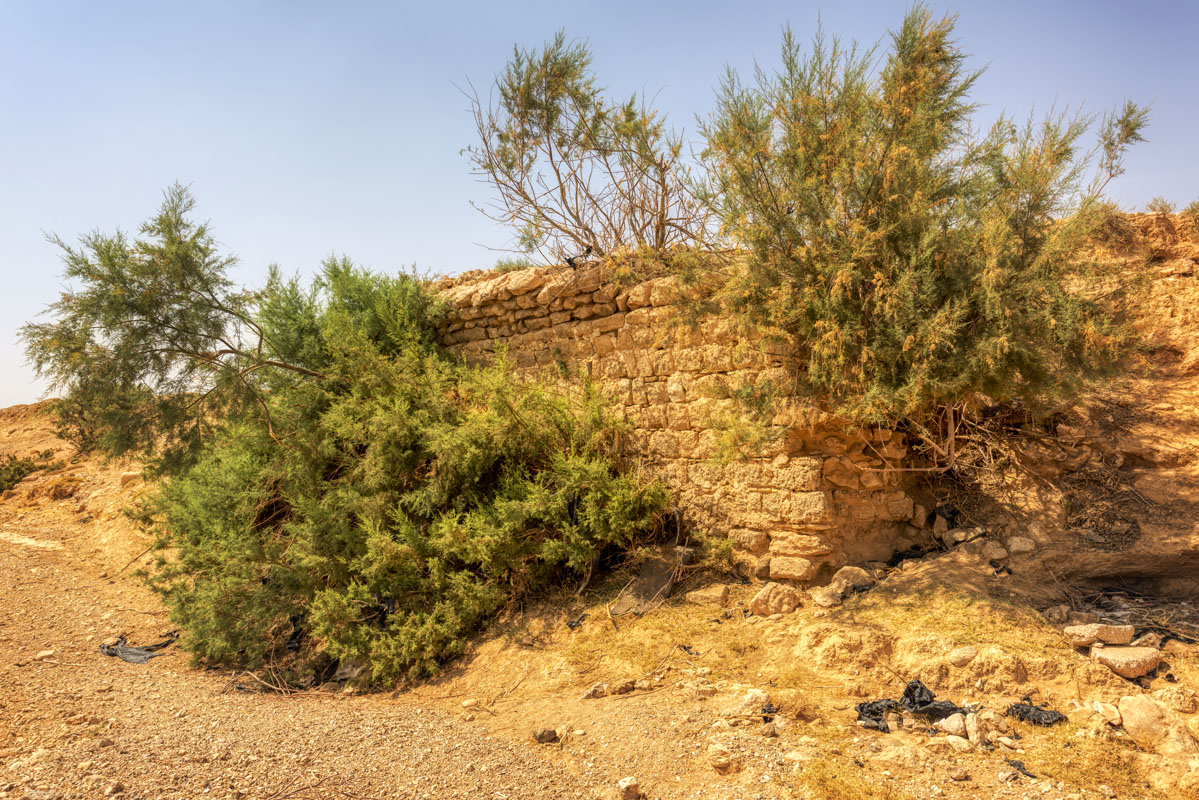
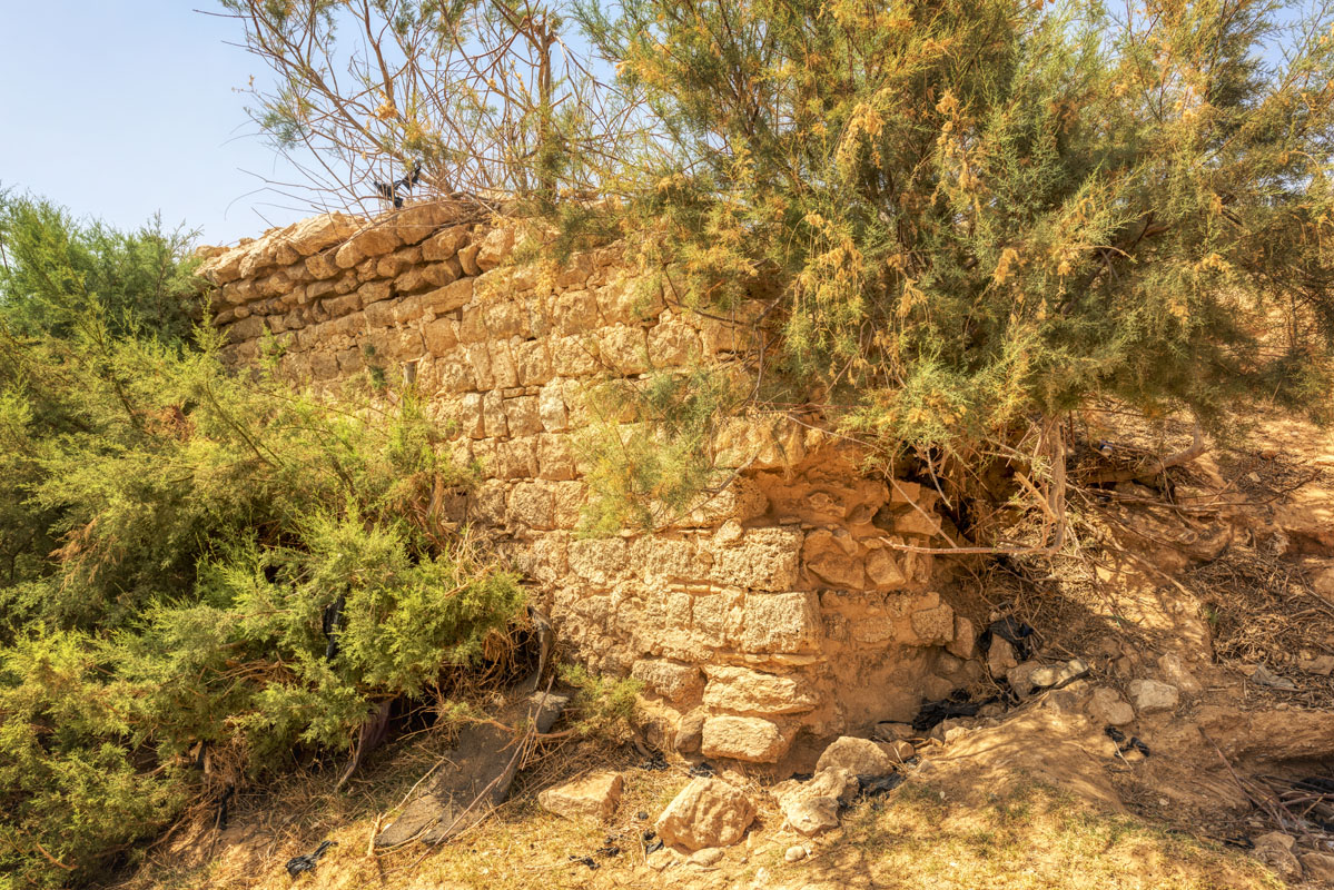
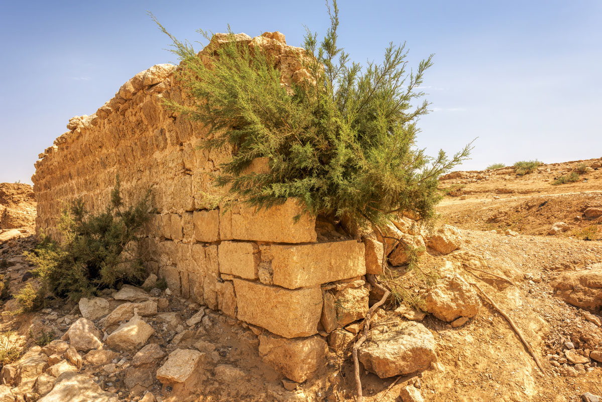
The fort lies on the ground sloping gently down towards the south of Wadi al-Hasa so that there is a difference of 0.7 m between the north and south sides of the building. None of the walls of the fort survives to their original height, the south side having been nearly destroyed (this wall has been partially rebuilt during restoration work carried out in the late 1980s and early 1990s). However, enough remains of the original north wall to show that it was built of well-cut ashlars, whilst the other three sides are built of roughly square limestone blocks and occasional blocks of basalt.
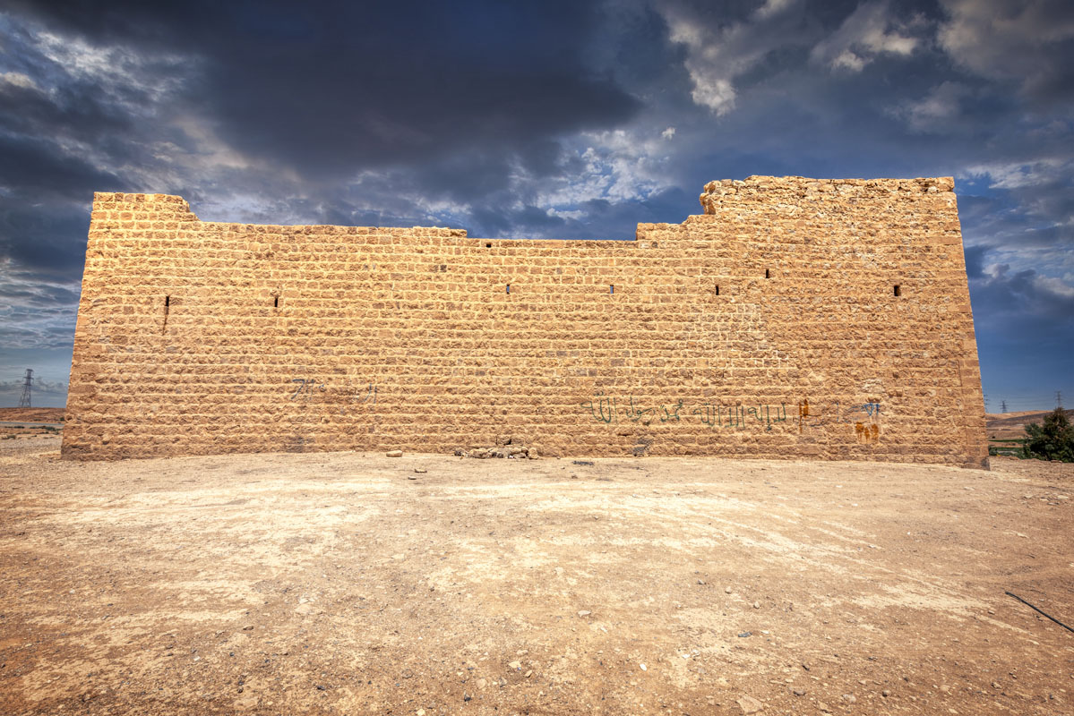
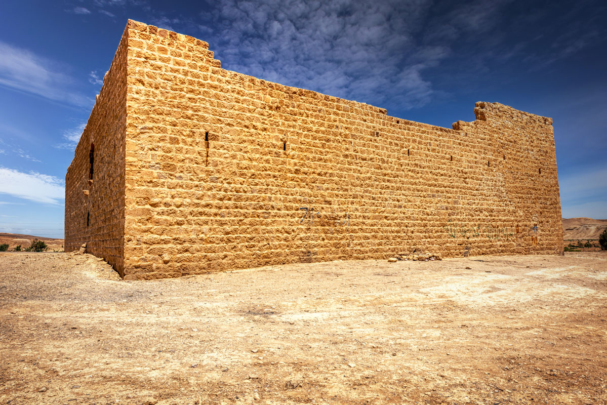
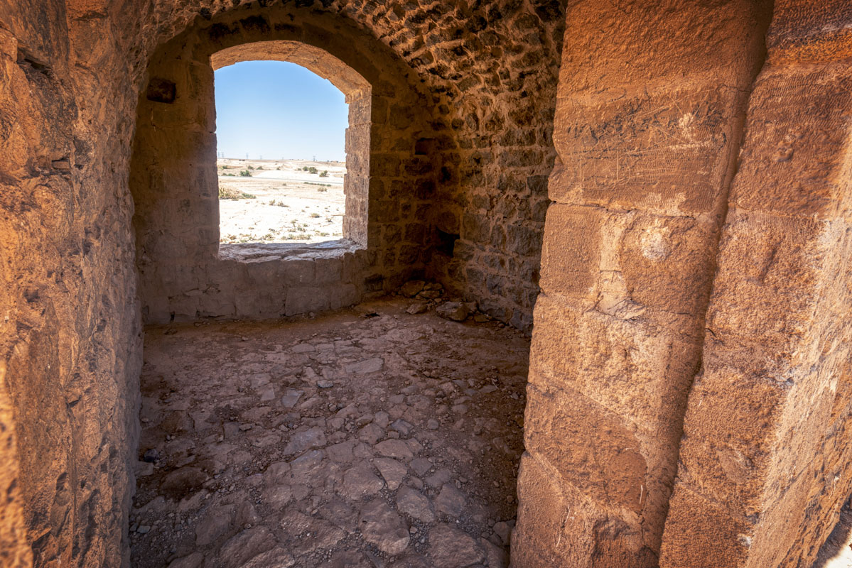
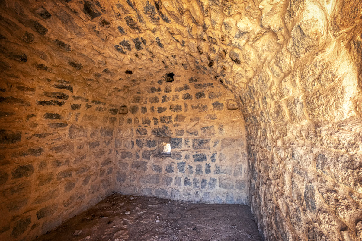
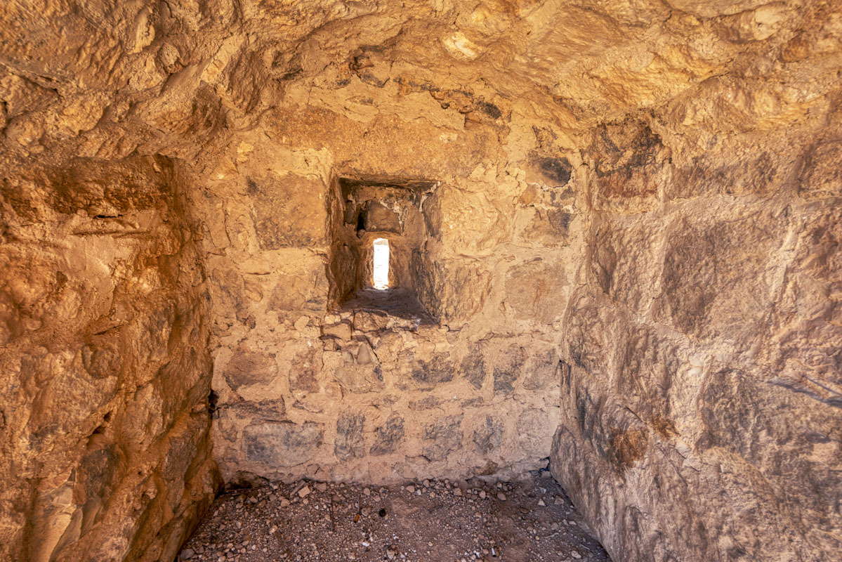
The south wall of the fort is of similar design to the west, with a series of small slit windows and a projecting gallery located to one side of the centre of the facade. Although most of the projecting gallery has collapsed, leaving a large opening in the wall, it is clearly of the same design as that on the west side. The windows on the first-floor level are similar to those on the west side (0.3 m high x 0.1–0.15 m wide), whilst those on the upper level are larger (0.75 m high x 0.35 m wide). The east wall stands to its original height, with one crenelation still visible. There is no evidence of a projecting gallery on the east side, although it is possible that there was a projecting gallery higher up which has disappeared. There are six small slit windows on this side, all located at the first-floor level.
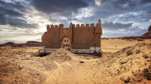
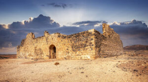
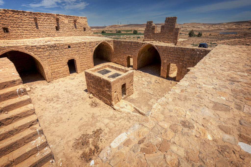
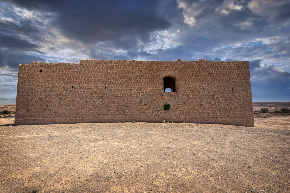
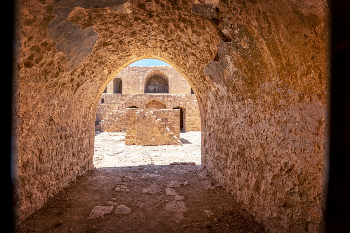
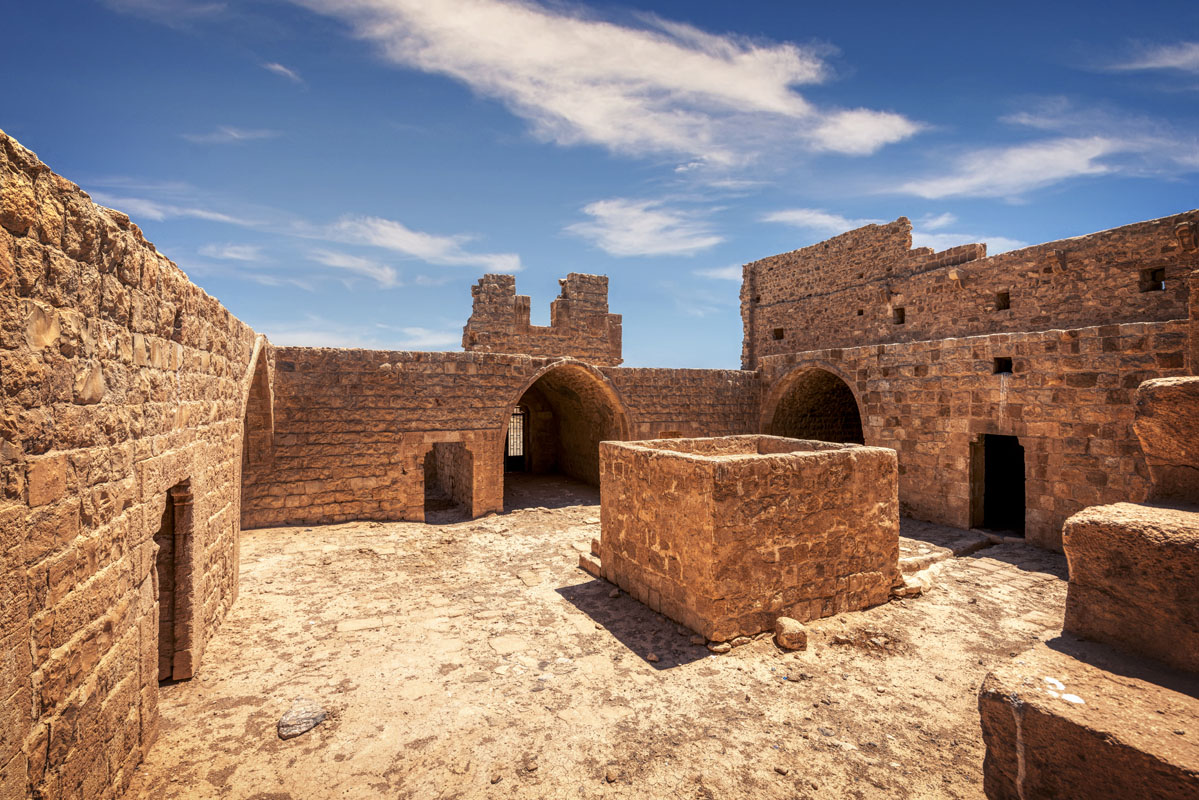
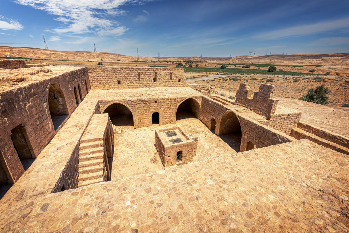
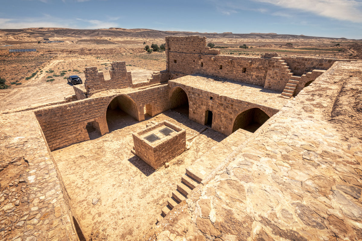
The entrance is located exactly in the middle of the south wall and is covered with a slightly pointed vault made of small flat slabs of limestone, covered in orange/buff coloured plaster. It leads into a square courtyard (12.5 m per side) paved with limestone slabs. In the middle of the courtyard, in line with the entrance, there is a tall rectangular structure built over a 10m deep well. Access to the well is either, through a small doorway on the east side of the structure, or via two holes in the roof. The roof is reached by a set of stairs on the north side.
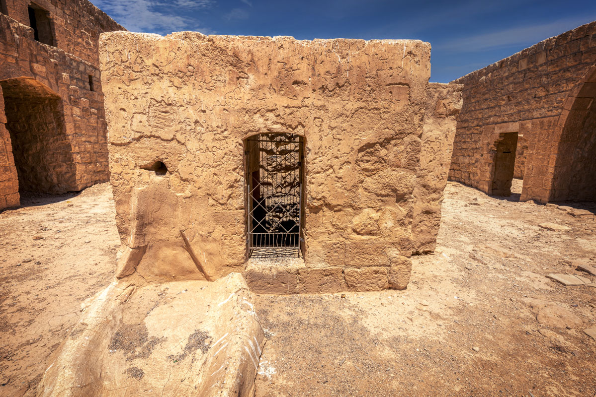
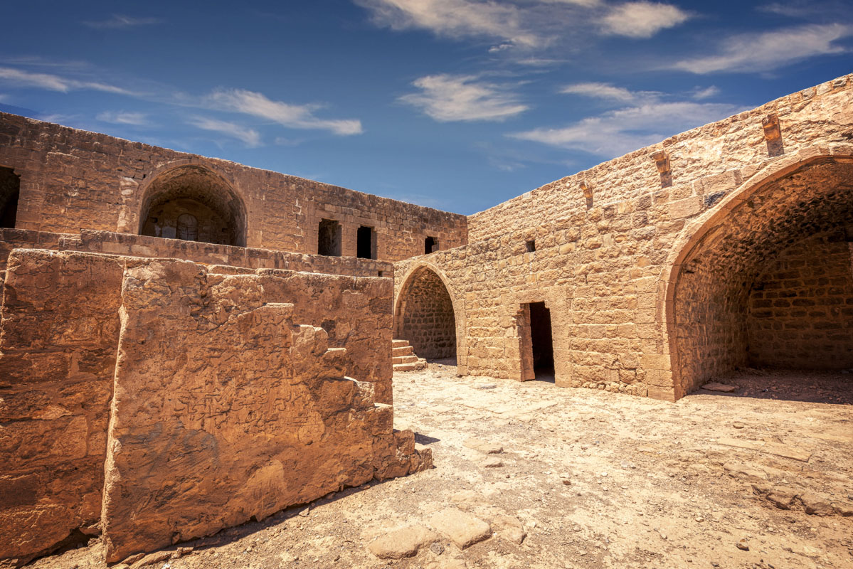
There are 9 rooms arranged around the interior of the courtyard. The two rooms on either side of the entrance, are in a ruinous, unroofed condition. Each room was covered with a barrel vault aligned east-west. The room to the west of the entrance has the remains of two transverse arches that are not bonded to the main vault and are probably secondary.
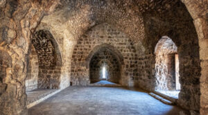
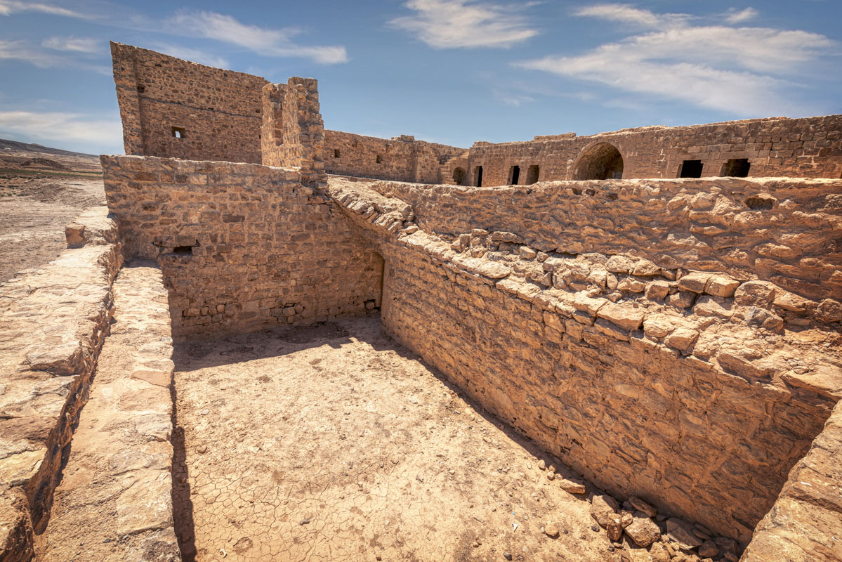
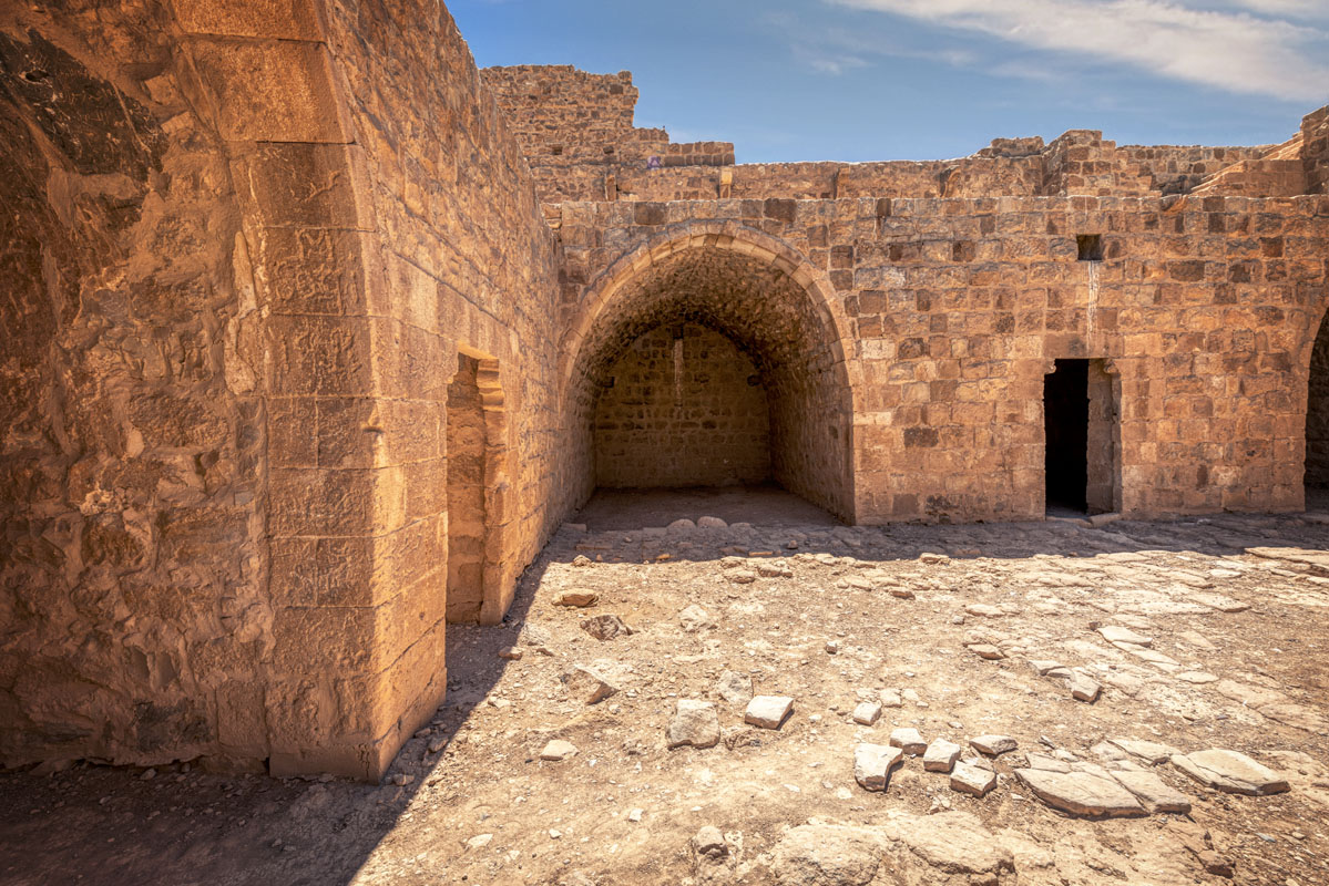
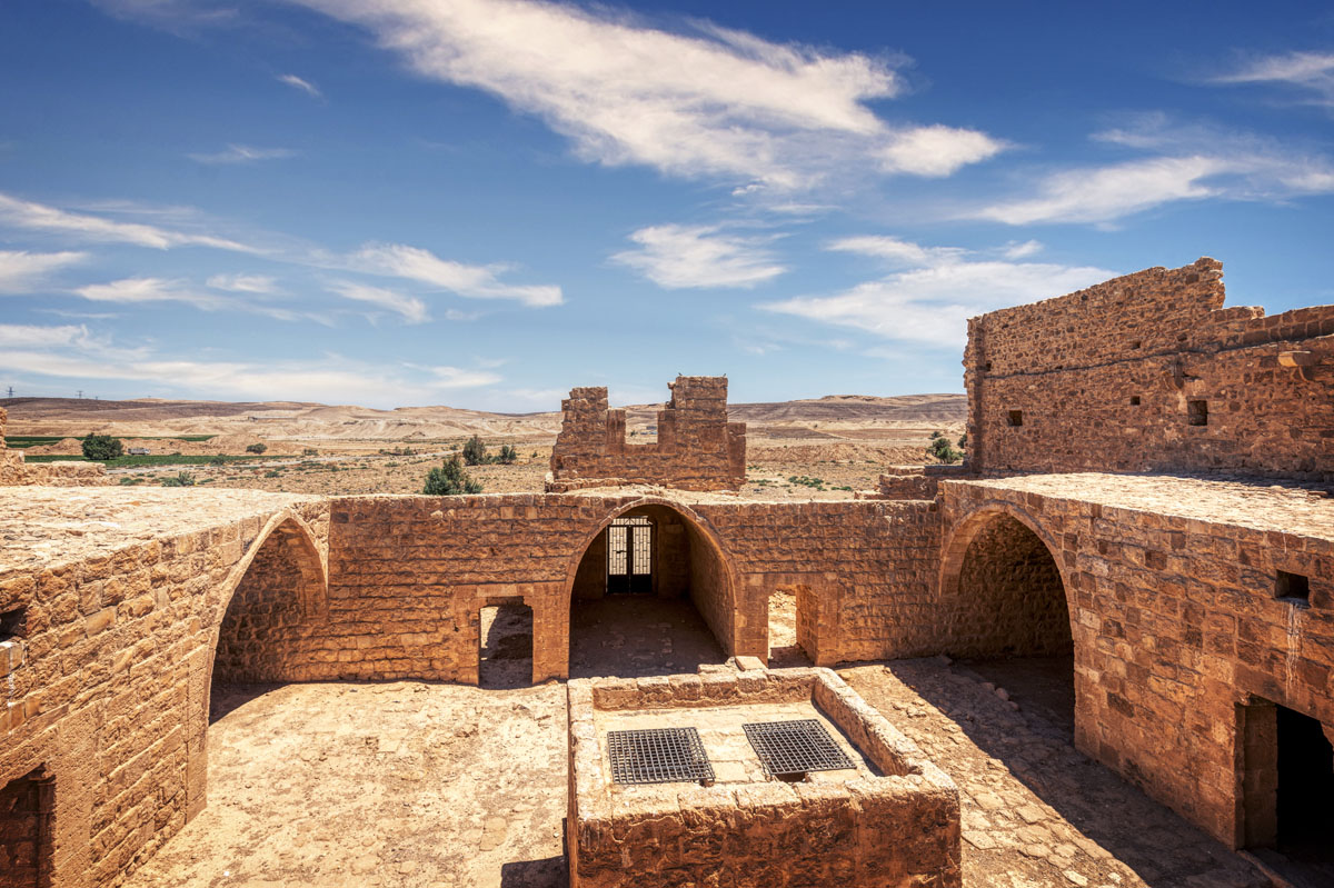
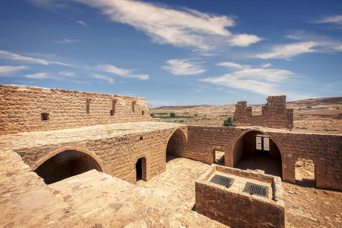
On the west side of the courtyard, there are two iwans (open vaults) on either side of a doorway giving access to a small, square, vaulted room. The east range is a mirror image of the west side, with two iwans, either side of a central room entered through a doorway. The south side of the courtyard is dominated by a double set of stairs leading up to the first floor. The stairs rest on a series of three arches, two of which are small recesses, whilst the largest arch in the centre contains a doorway leading into a single, long, vaulted chamber.
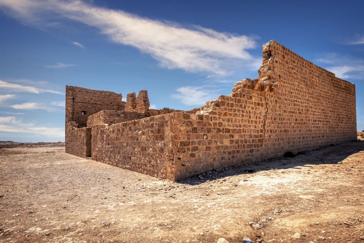
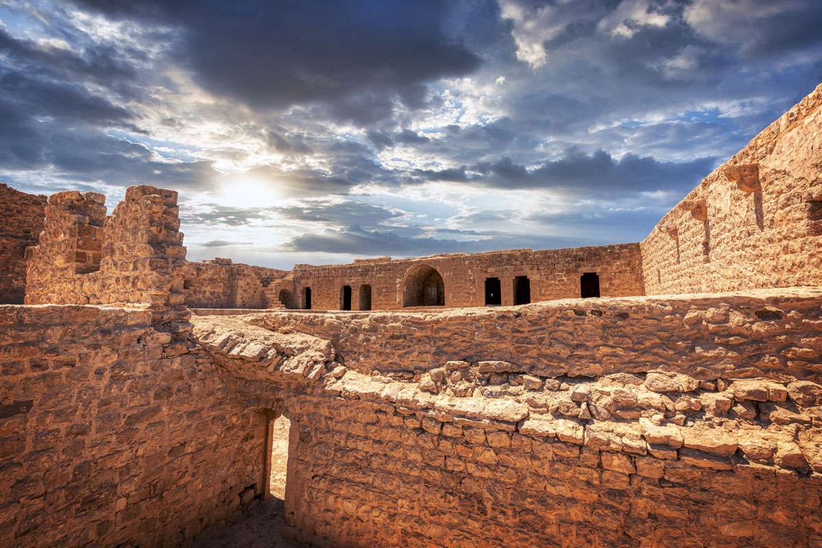
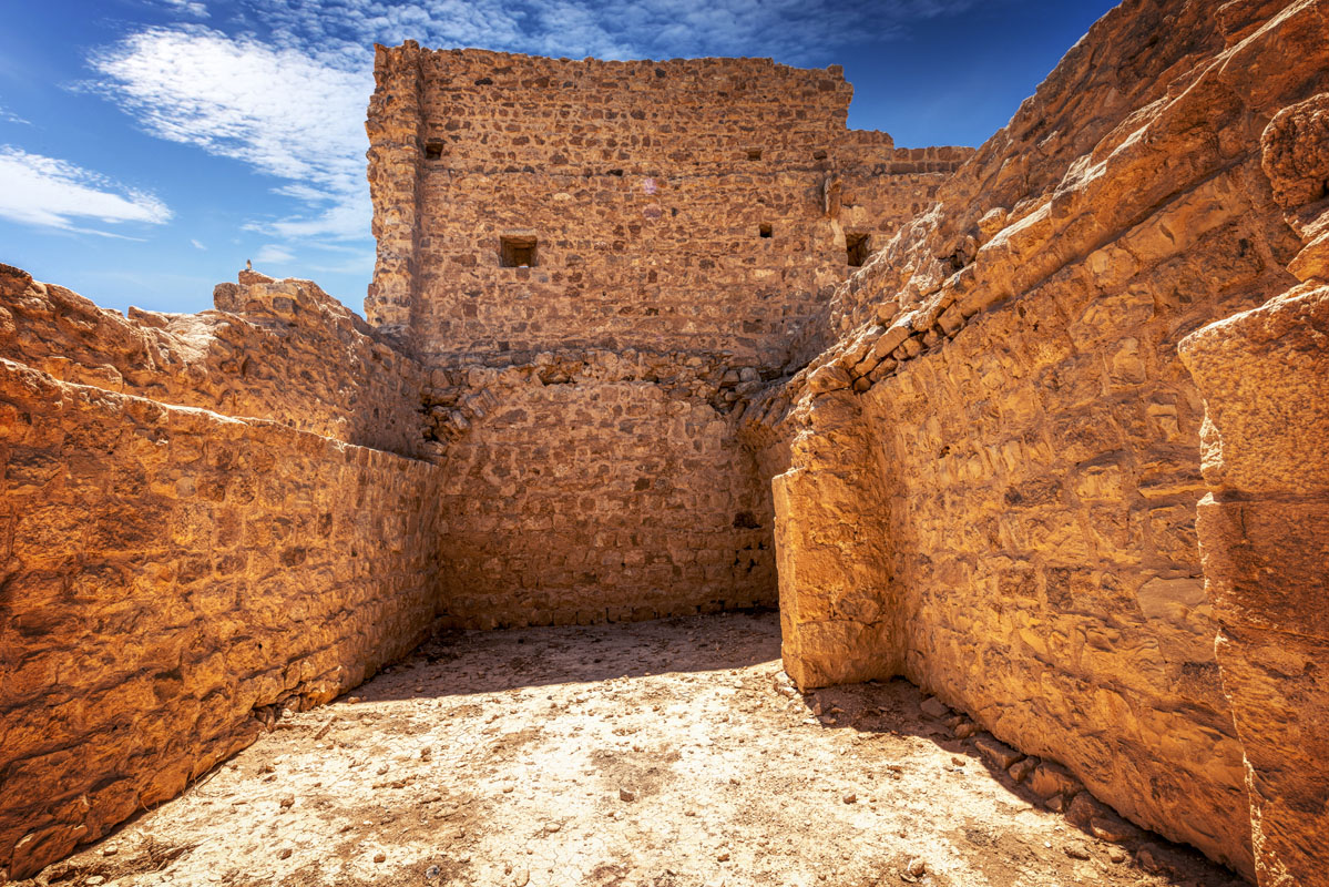
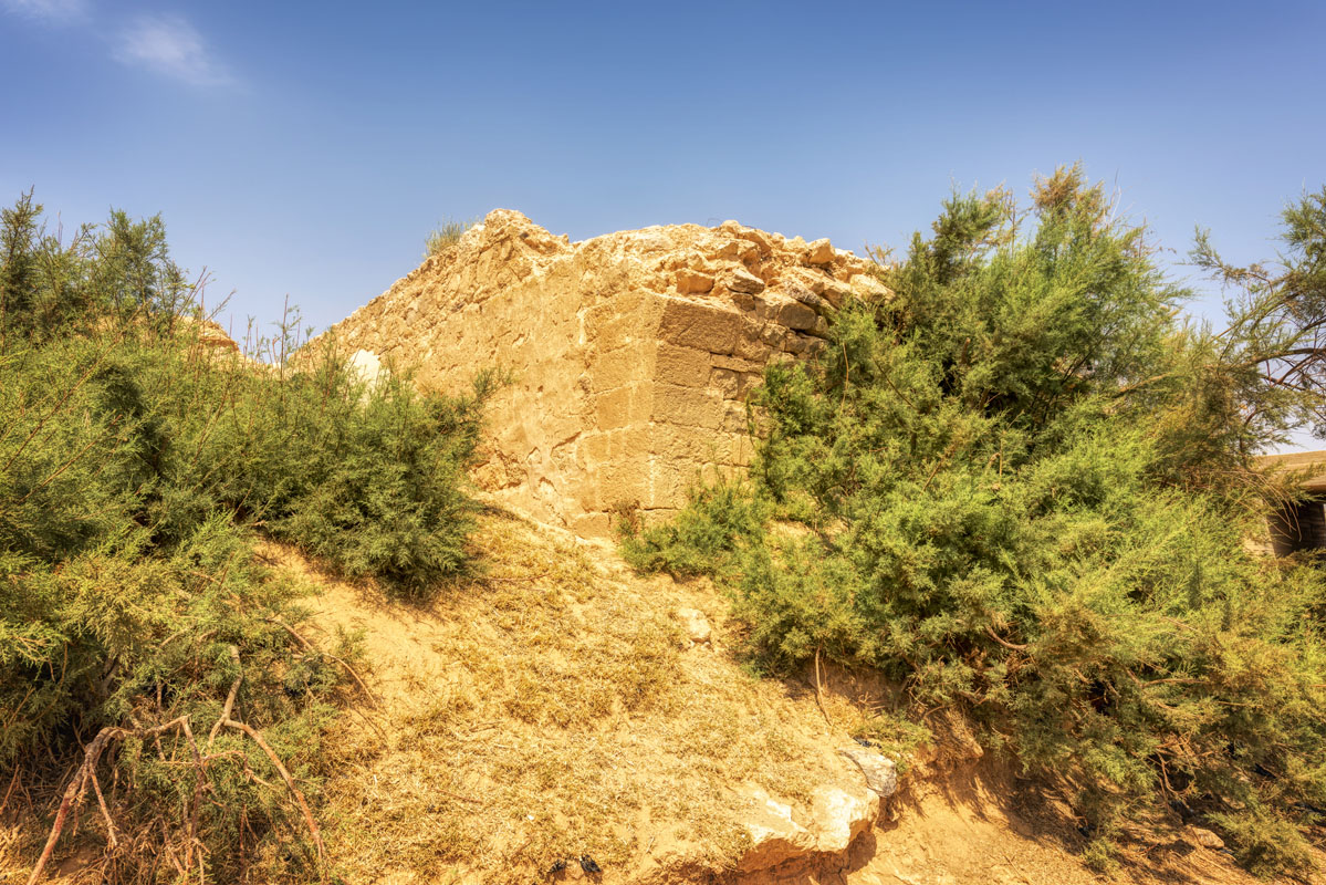
The first floor has been very badly ruined so that complete rooms only survive on the southern side of the courtyard, except for one small section of wall, directly over the gateway, containing a large rectangular window facing into the courtyard. The southern range of the first floor contains six barrel-vaulted rooms, three on either side of a central iwan. The iwan is also roofed with a barrel vault and contains a plain mihrab in the centre of the south wall. An inscription in this room, now lost, recorded the construction of the fort in 1760. There are no traces of rooms on the east or west sides, although there are projecting corbels that may have supported a parapet walk. In the southeast corner, there is a set of stairs leading to the upper floor and the parapet walk.
The only extant remains of the upper floor area on the south side where two gun slits can be seen. By analogy with other forts, it is unlikely that there were rooms on this level, though the flat roofs on the south and north sides would have been connected by a parapet walk supported on stone corbels. There may also have been a projecting gallery, or machicolation, at this level on the east side.
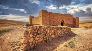
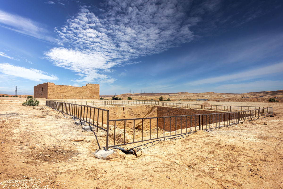
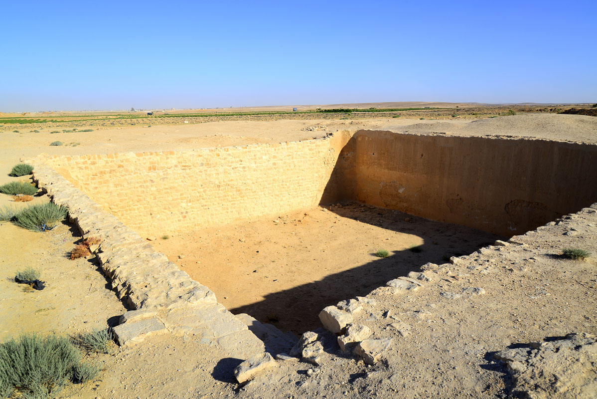
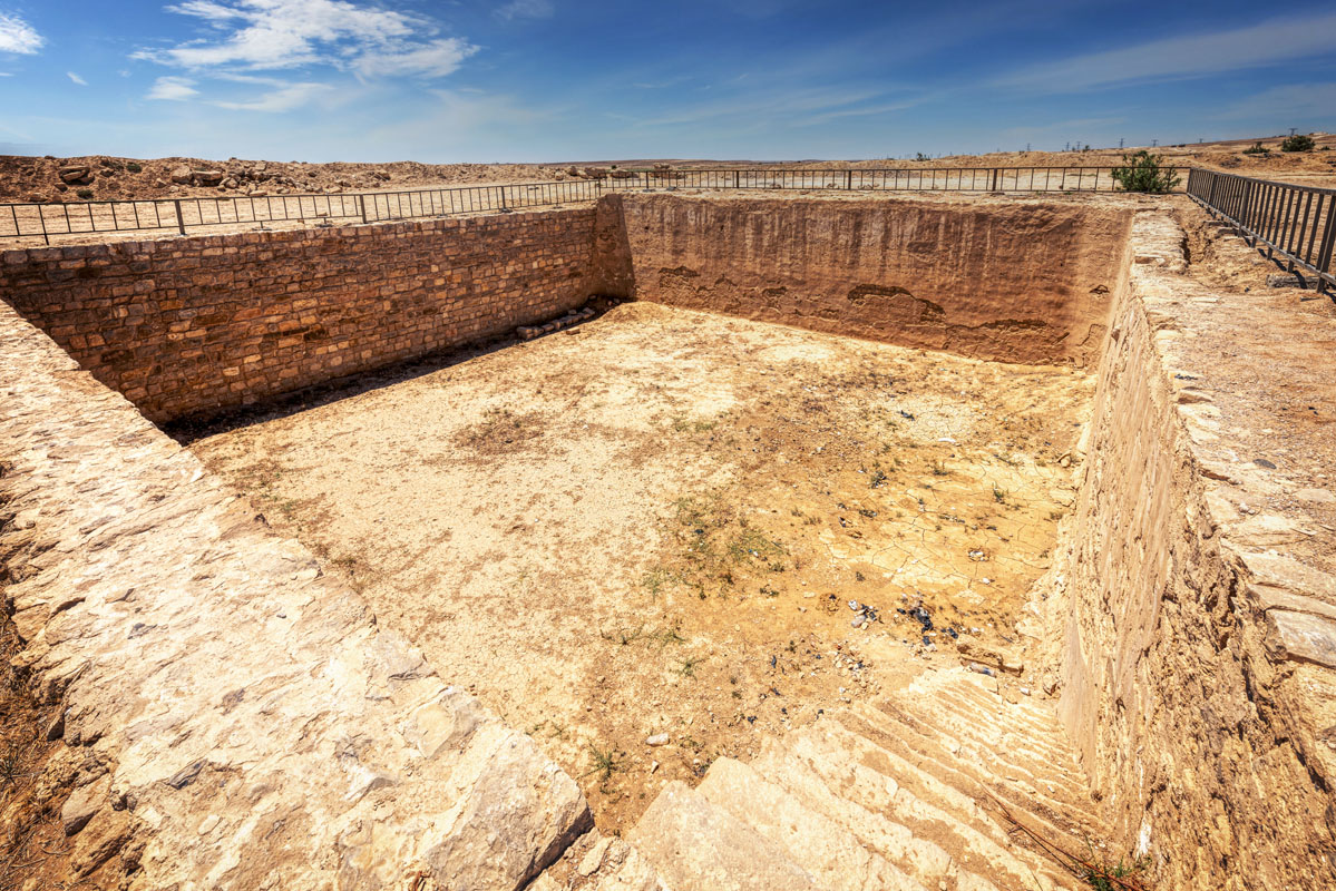
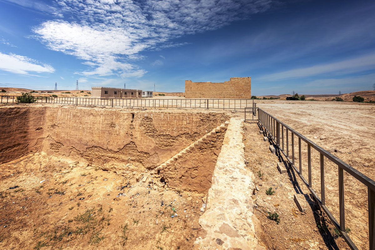
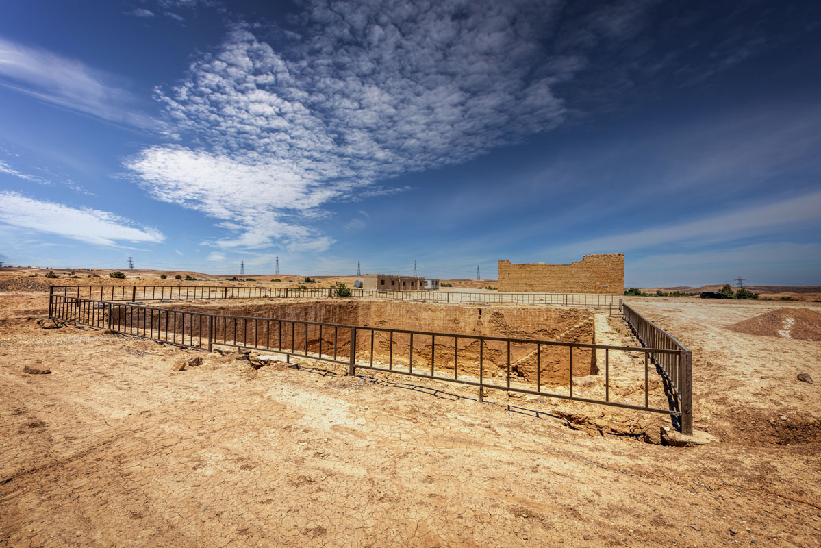
The water reservoir is a fairly small structure (20m on each side) lying 50 m east of the fort. The walls of the reservoir (0.75 m thick) are made of squared limestone blocks and lined with plaster. In the northwest corner, there is a set of steps running downwards into the reservoir, along the west wall. Further along, near the top of the west wall, there is a small opening or inlet connected by an underground channel to the fort, where it is fed by the well in the centre of the courtyard.

Qal’at Al-Sasa is a stop on the pilgrimage route during the Ottoman period, first mentioned in the itinerary of Mustapha Pasha in 1563 AD. In the 18th century Murtada ibn, ‘Alawan lists Hasa as a stop between Qatrana and ‘Anza. Some 30 years later the governor of Damascus, Aydinili Abdullah Pasha, built a bridge across the Wadi al-Hasa to mitigate the effects of flash floods. Since Aydinili Abdullah Pasha also had a paved road built between Damascus and Qunaytra and strengthened the river banks between Sanamayn and Muzayrib, likely, he was also responsible for the paved road leading up to the bridge at Hasa. In 1779 Hasa was visited by Mehmed Edib, who states that, because it contained the burial site of Celaleddin Halveti, it was also called Tabut Korsu, or burial grove. Edib states that the bridge is called Lejun and mentions that there was also a fort and cistern at the site. He explains the importance of the bridge, placed at a point where floods were frequently life-threatening. Nevertheless, drinking water at the site was scarce. He also mentions another stopping place nearby called Uziyr Sultan, which is infested with robbers.
In the early 19th century, the facilities at al-Hasa were inspected on behalf of Muhammad ‘Ali Pasha. The report noted that the two corners of the fort had been damaged in an earthquake many years before and that repairs carried out were inadequate. The report also noted that floodwater had swept away a 40 cubit long section of the bridge embankment. In the 1860s Christophe Mauss and Henry Sauvaire passed through al-Hasa on their way to Shawbak. They noted the square fort and large adjacent cistern, as well as the bridge of two arches and a portion of paved road. Within the fort, around the central courtyard, was a series of storerooms, as well as living rooms for the garrison. They noted that the guards had lived in the area for several generations and had planted a small garden between the fort and the cistern. They stated that the road marked the edge of the desert and was similar to the Roman road at Dhat Ras.
In the early 1980s, the fort was surveyed as part of the Wadi al-Hasa Archaeological Survey, which surveyed the length of the Wadi, from its origins in the high desert plateau in the East to the point where it entered the Dead Sea in the West. In addition to the fort, the bridge and the road the survey identified the remains of three Ottoman period villages, as well as a huge enclosure with a diameter of 240 m. It is thought that the enclosure was used by the Hajj caravan, either as a camping ground or as an area for corralling animals.


