
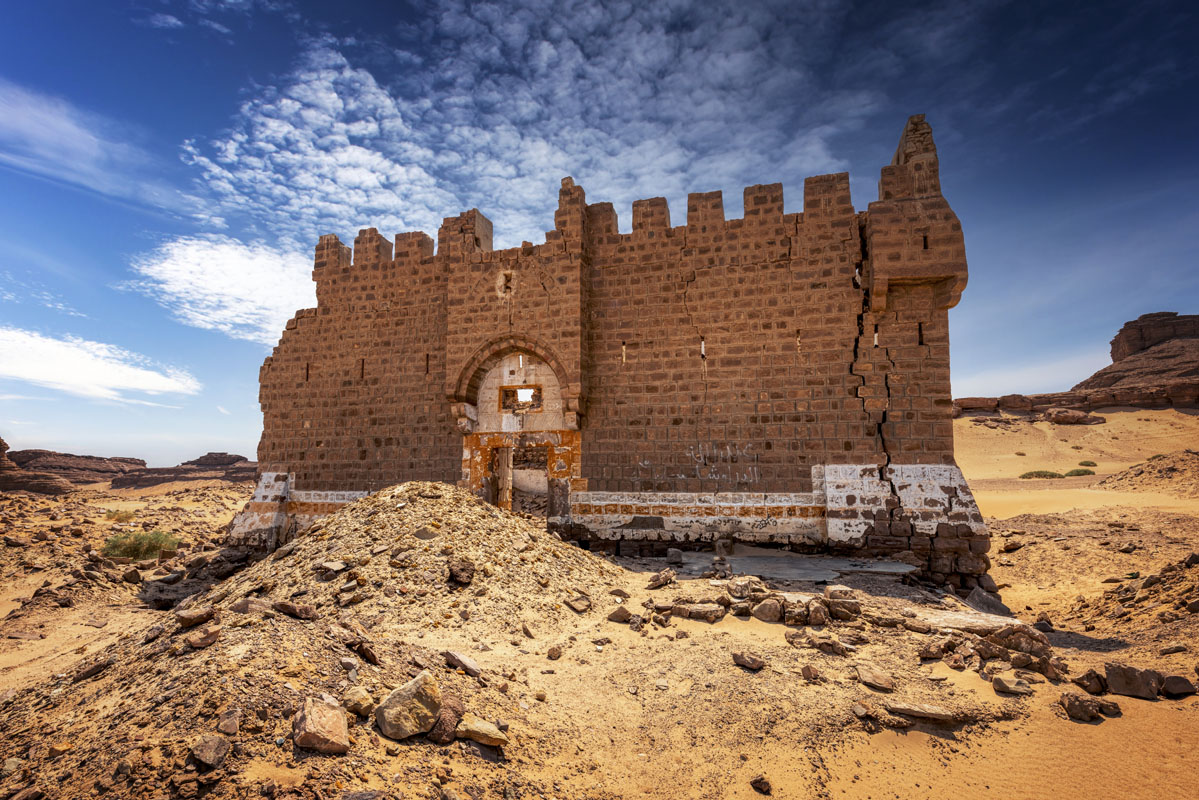
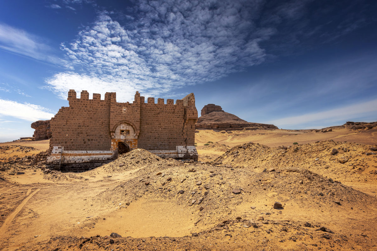
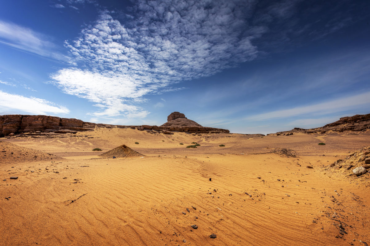
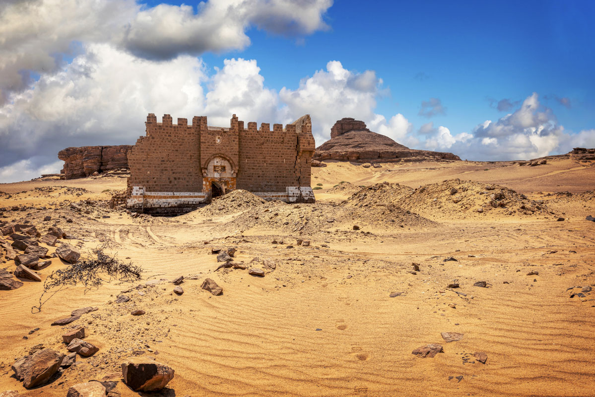
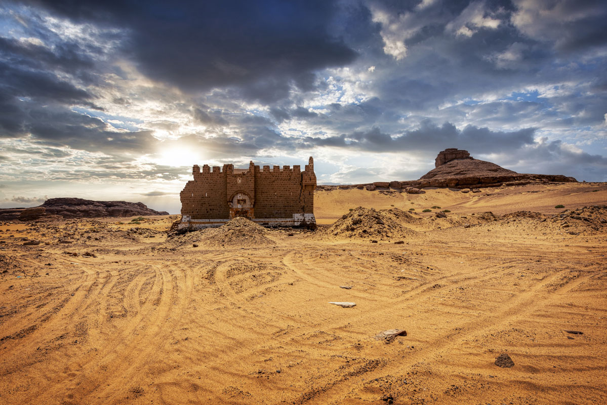
This site lies in a sandy desert at the southernly most point of Jordan, 15 km north of the Saudi border. Although the area is predominantly flat there are several sandstone rock formations in the vicinity of the fort. The site consists of a Hajj fort, a reservoir and a section of stone cobbled road.
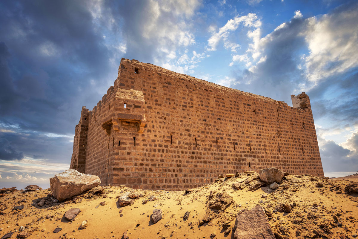
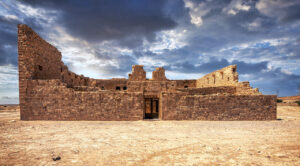
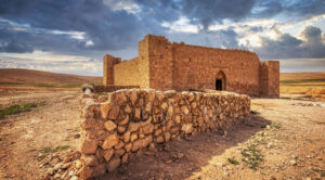
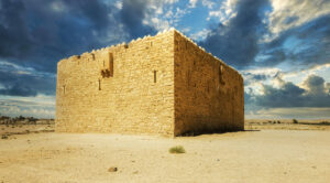
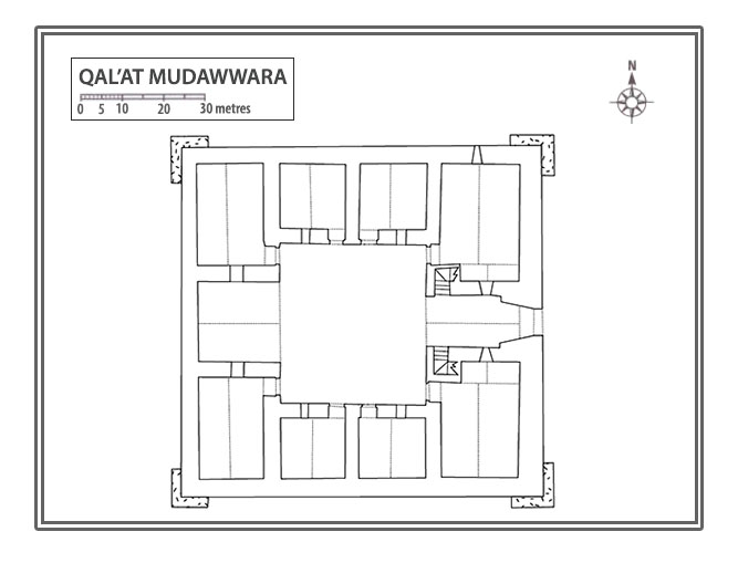
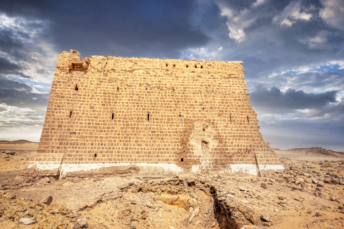
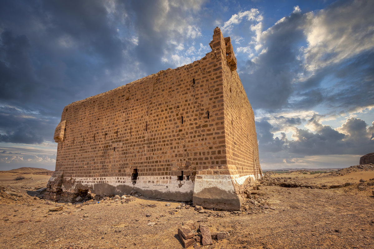
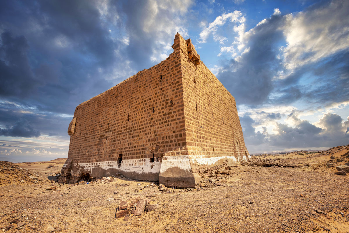
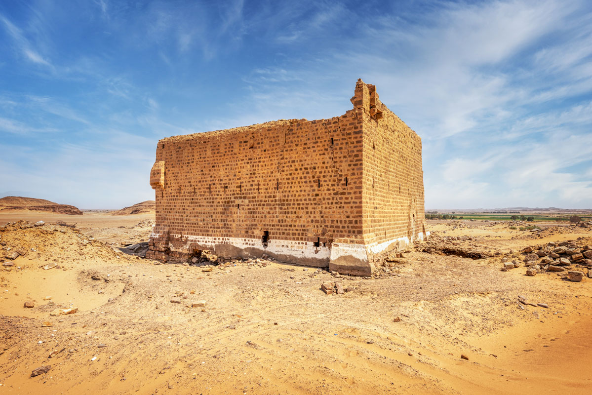
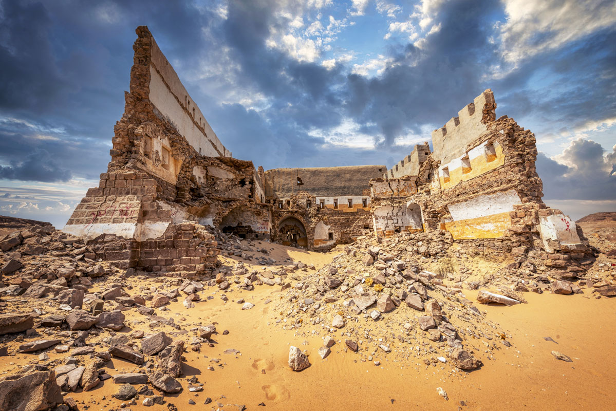
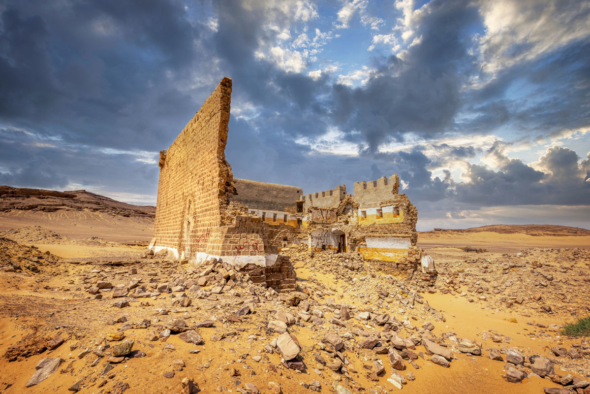
The fort is built of dressed sandstone blocks and stands on a sandy ground surface, which slopes gently down from the north to south. It is built directly on the sand, with wide foundations splaying outwards, so the structure is ‘floating’ on the sand. The walls comprise an inner and outer face and become progressively thinner as they get higher. The east and south walls of the fort are lower than those on the north and west sides which have been built 0.9–2 m higher.
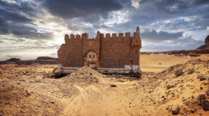
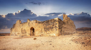
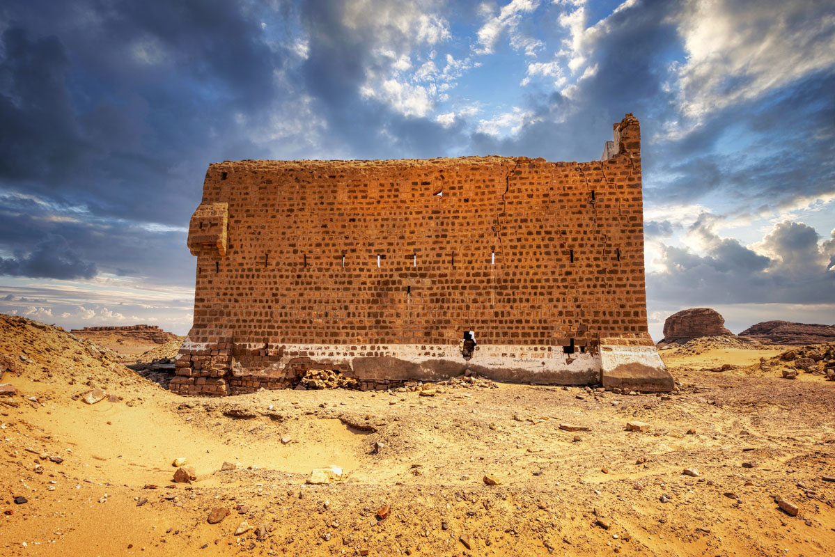
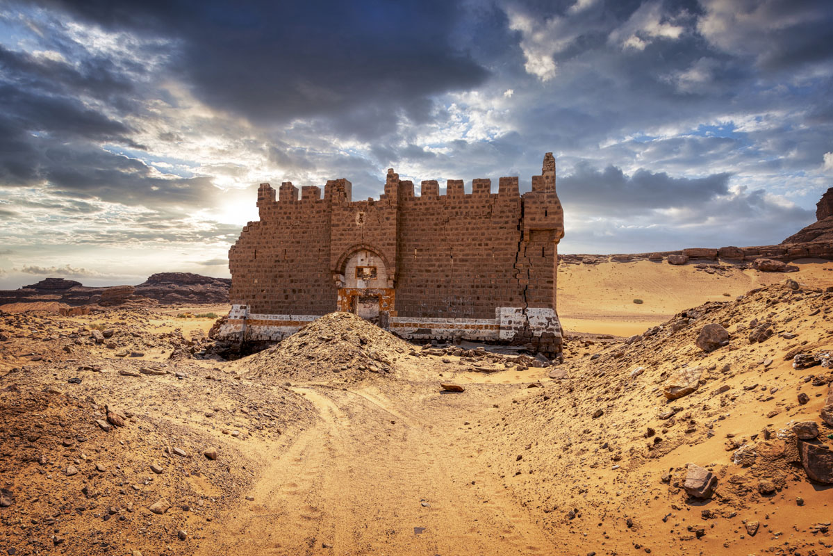
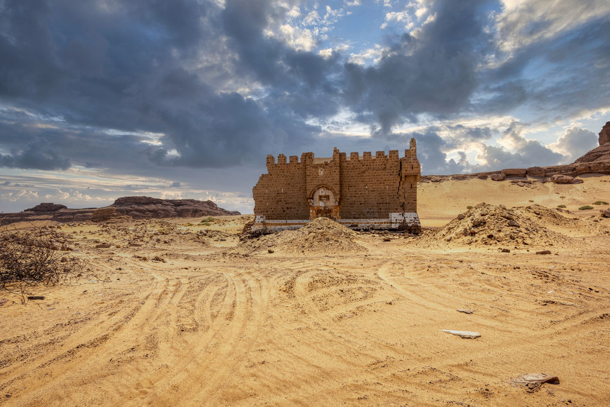
The entrance to the fort is in the middle of the east side and comprises a rectangular gateway (1.3 m wide) set beneath a large projecting machicolation. The gateway comprises two jambs made of monolithic sandstone blocks (2.3 m × 0.55 m) and a lintel also made of a single sandstone block (though this was cracked in two places). Above the lintel is a series of voussoirs arranged to form a flat relieving arch. Above this, there is a rectangular recess, which probably once contained an inscription. The inscription panel is set within a wide arch, which forms the lower part of the projecting machicolation. There have been some very serious undermining of the fort, under the middle of the south wall, which has led to the collapse of this side of the fort. The south wall was of similar design to the east side, comprising a series of eight-gun slits at first-floor level and 11 gunports at parapet level, capped by a series of crenellations.
The west face contains a series of six-gun slits at the first-floor level and the second series of smaller openings on the second floor. At the top of the wall, at parapet level, another wall has been added to increase the height of the fort. This upper section of the wall is distinguished by the fact that it is built of rough stone blocks covered in plaster. The north face is similar to the west.
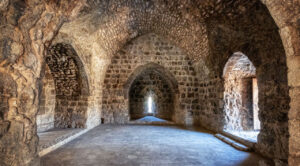
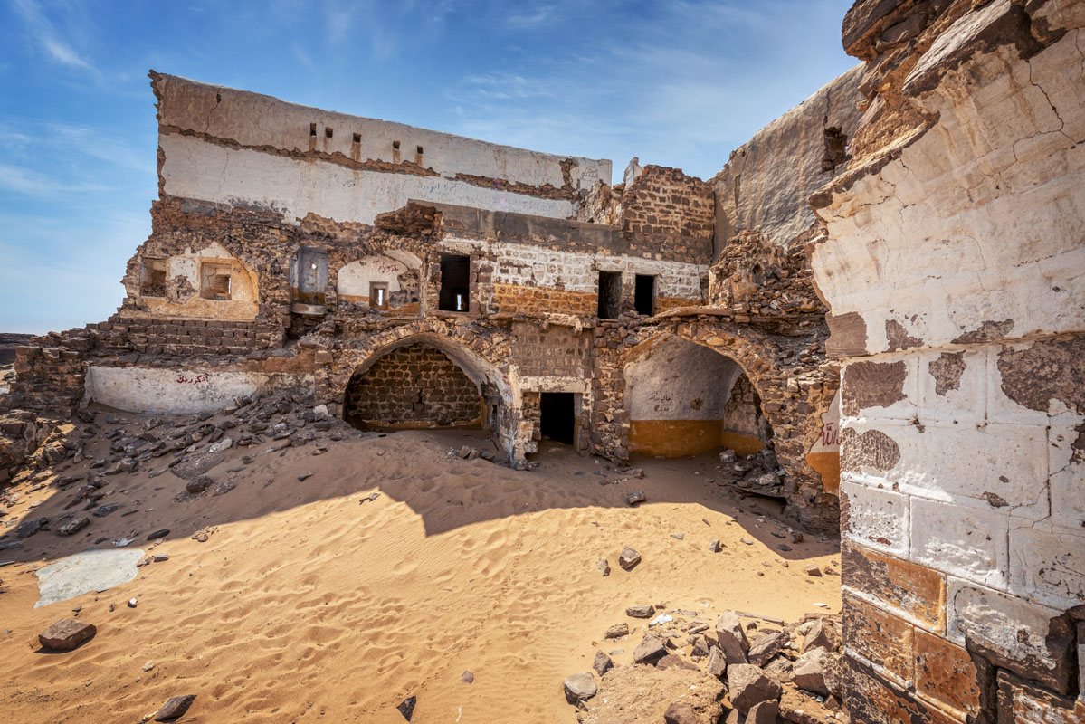
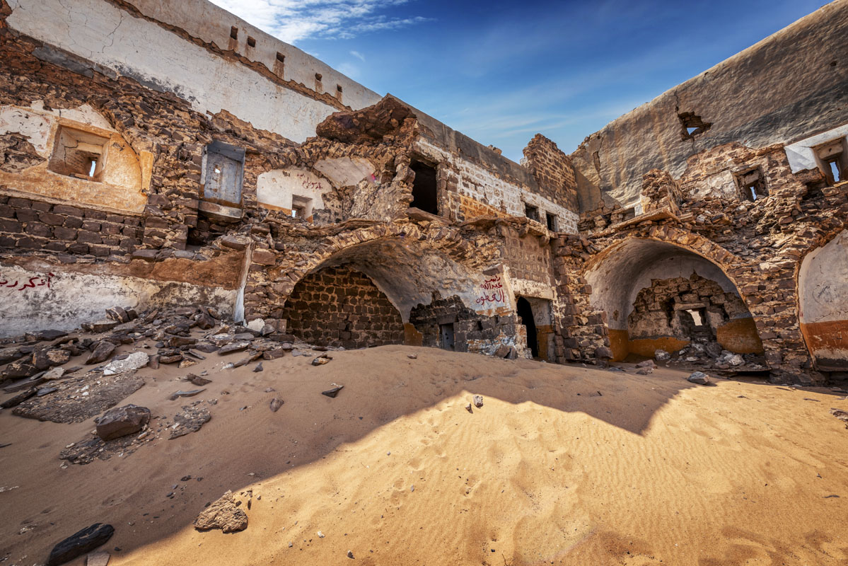
The entrance to the fort leads into a tall, vaulted passage (4.2 m long × 2.6 m wide × 3 m high) and into a square, central, courtyard paved with stones. There are 9 rooms on the ground floor, excluding the entrance passage; all are barrel-vaulted. Directly opposite the entrance, there is a large iwan that occupies most of the west side of the courtyard. The arrangement of rooms is symmetrical along an axis running, east-west, through the gateway, thus there are four rooms on each side. All the rooms are entered via small doorways (0.7 m wide × 1.5 m high). The first floor is reached by either one of two staircases ascending from the entrance passage. The plan is identical for both sides, comprising a 90% bend and ascending to a narrow corridor running along the east face of the fort. Three rooms open off this narrow corridor and have windows opening into the courtyard.
Eighty-two metres to the south of the fort are the remains of a large, rectangular, cistern, with sides measuring 31.8 m north-south and 15 m east-west. The sides of the reservoir are composed of dressed sandstone blocks on the interior face and roughly squared, flint and sandstone blocks in the middle and exterior faces. The width of the walls varies between 1.05 m and 0.75 m. The southeast and south-west corners are right angles, whilst the northern corners have a rounded form. There is no visible sign of the cistern next to the fort, which is mentioned in the Report to Muhammad ‘Ali Pasha and it has likely been completely covered with sand.
One and a half kilometres to the southeast of Mudawarra are the remains of a cobbled road, stretching for over 500 m. The road is made of flint cobbles edged with sandstone, with a width of 4–5 m.
All the structural remains at this site appear to date from the 18th century, or later. The cobbled road is similar to that at al-Hasa, which suggests that it is also contemporary with the construction of the fort in the 18th century. The road was probably built to avoid the worst of the shifting sands, which created fear in the minds of some pilgrims. The fact that the fort continued in use up until the 1950s means that many of the features, visible in other forts, have been replaced or modernised.

The site is first mentioned as one of the principal stops on the Syrian Hajj route, in the writings of the 9th-century author, Ibn Khurdadhbih.
In the 16th century itinerary of Mustapha Pasha, the site is listed as Tubaylayat. Later on, in 1672, the Turkish traveller, Evliya Celebi, referred to the site as Kudrat Jugayman. He noted that it contained a castle built out of rock, without any sign of an entrance. To the south of the fort, there was a well called, Asma, after the sister of Suleiman Khan. The name of the site, Kudret Jughayman, probably derives from the early 16th century Bedouin chieftain who harassed pilgrims. The rock-cut fort with no door may be explained by the striking natural rock outcrop located behind the fort.
In the 18th century the Governor of Damascus, Aydinili Abdullah Pasha, ordered the construction of a fort and two cisterns at al-Mudawwara. Half a century later the fort was visited by Mehmed Edib, who stated that it was built by Abdullah Pasha, at a distance of 15 hours from Fassu‘a. He noted that water was scarce at this site and was only found around the fort. He also observes that the sand around the fort appeared to be impassable, giving the impression of a vast ocean.
In the early 19th century, the site was inspected for The Report to Muhammad ‘Ali Pasha. The Report referred to the site as Mudawwara and stated that it contained a square fort (50 × 50 cubits) and two cisterns, one small cistern next to the fort and a large rectangular cistern (50 × 30 cubits) at some distance. The Report noted considerable problems with water at this site, including both a low water table and shifting sands filling up the cisterns.
During the First World War, Mudawwara was the scene of some fierce fighting, in particular, when British and Arab forces attacked the site from Aqaba to prevent it from being used as a base from which the Turks could attack Palestine.


