
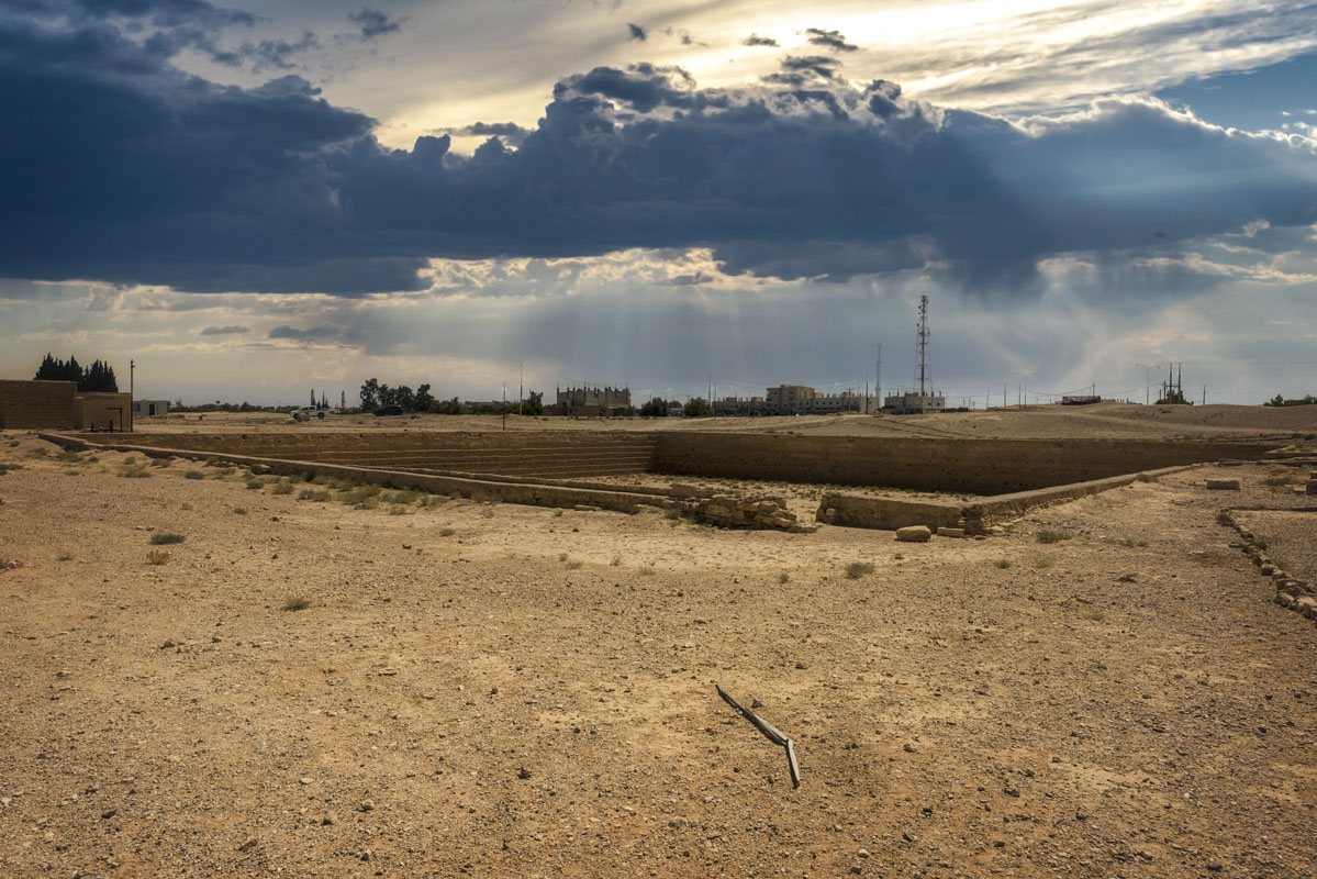
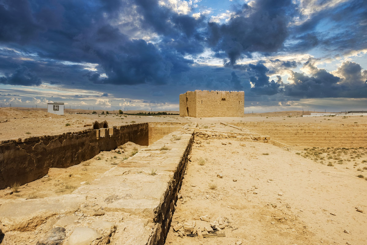
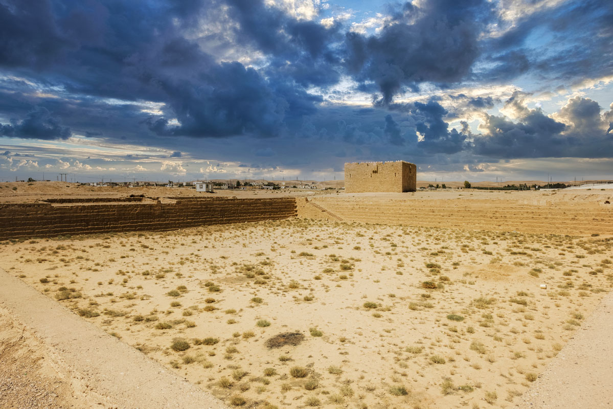
Qal’at Qatrana is located to the south of Qatrana village, 95km from Amman. The site comprises a fort, a large reservoir joined to a smaller reservoir and two tunnels which connect to the Wadi Hanifa via sluice gates. Qatrana, built in the 16th Century AD, was an important station on the Hajj route and was seen as a place where Bedouin and Ottoman officials could negotiate with each other.
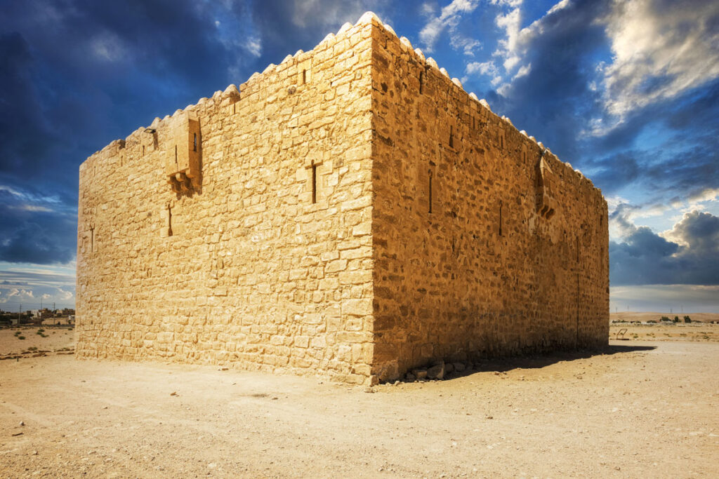
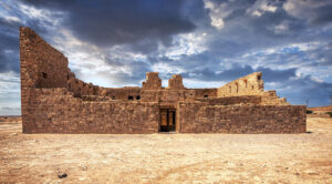
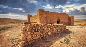
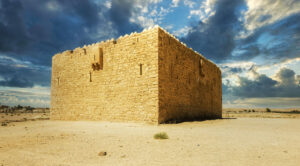
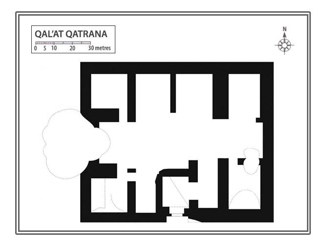
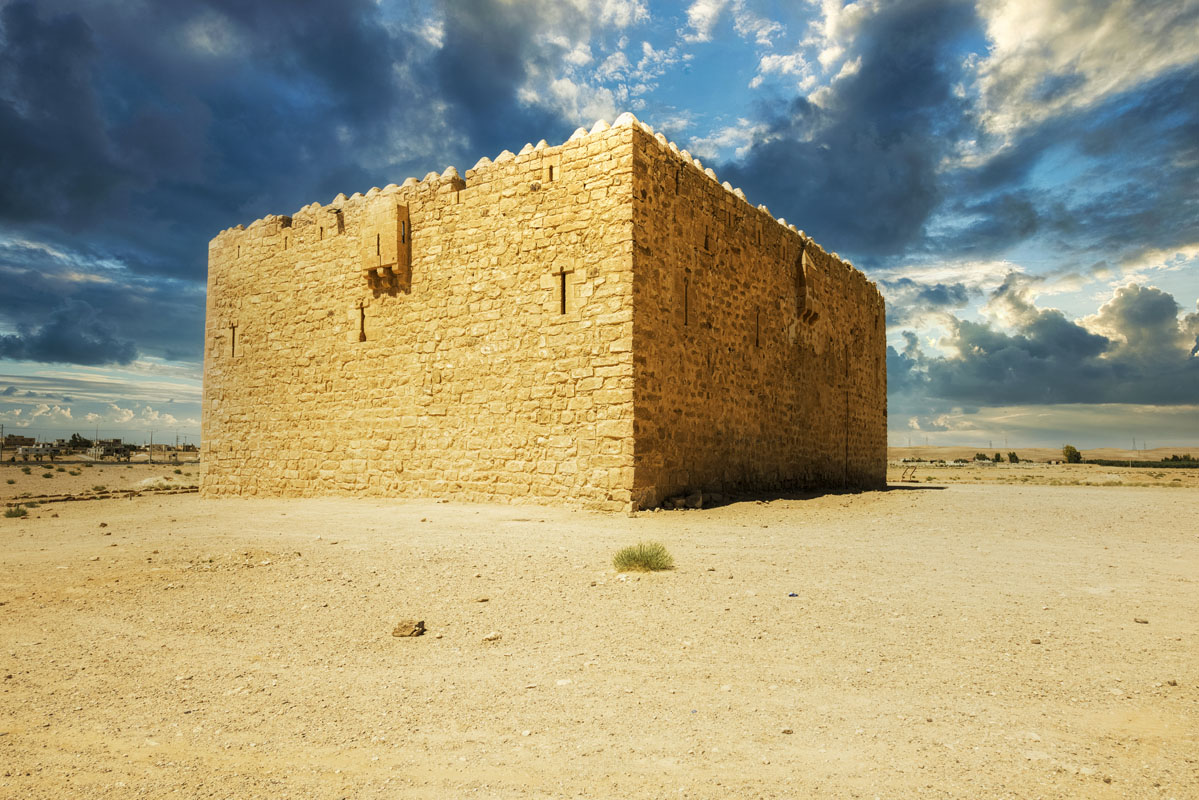
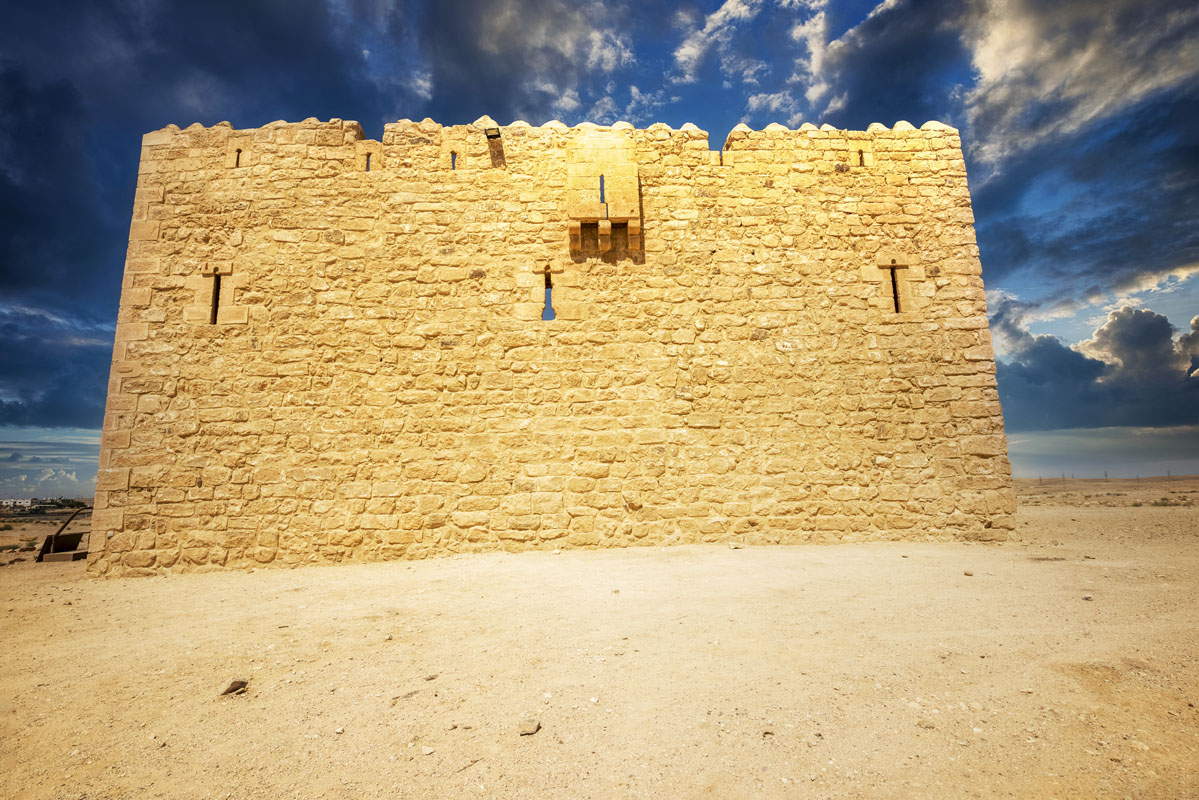
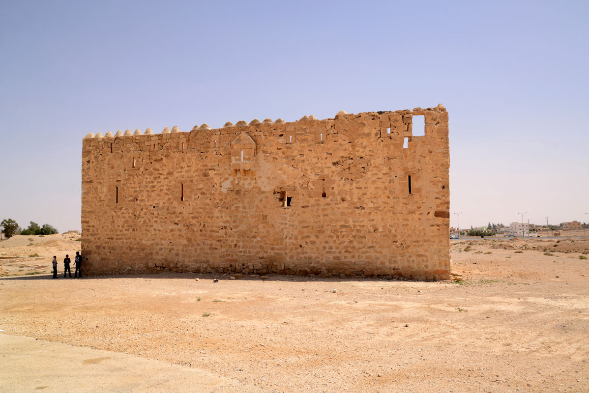
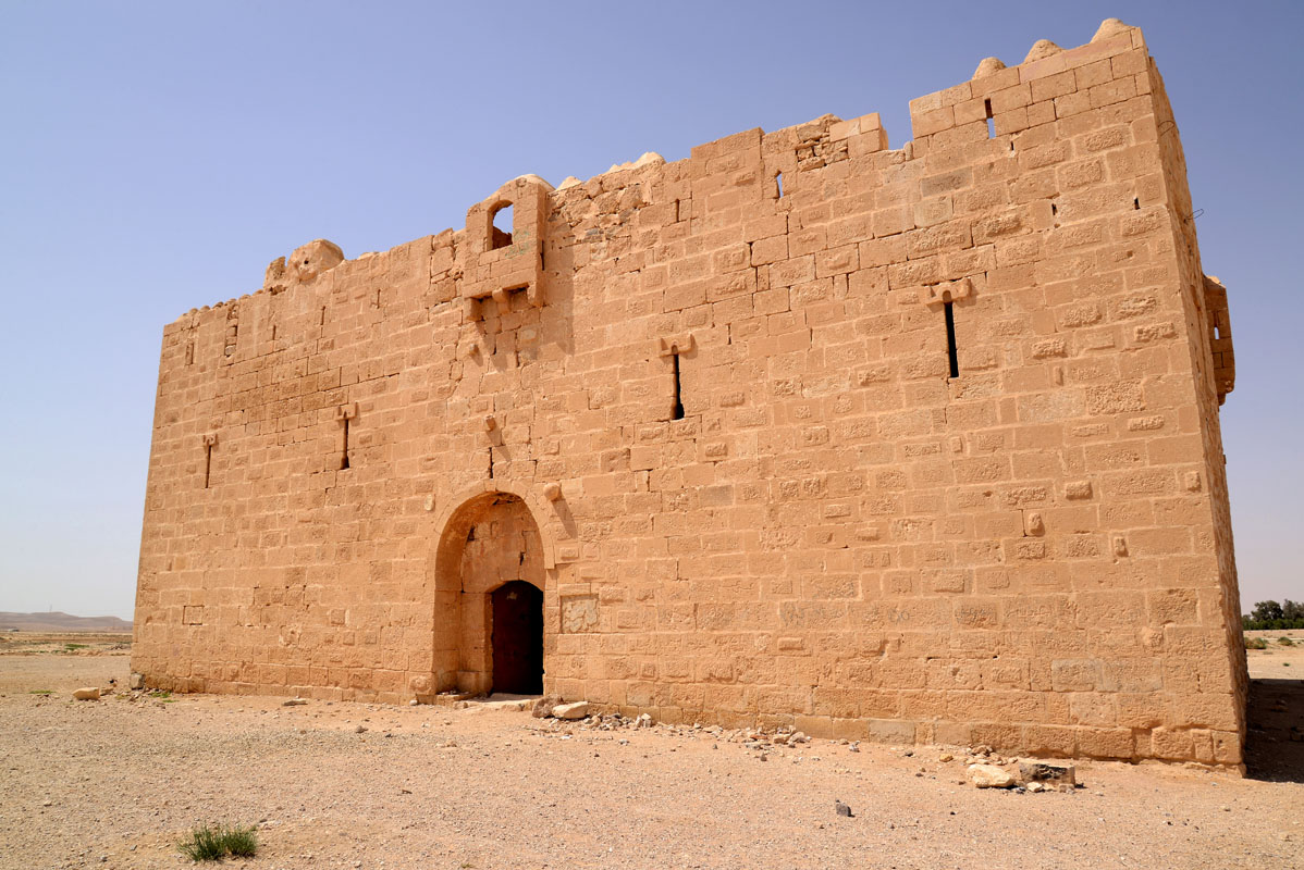
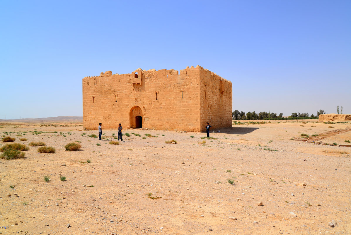
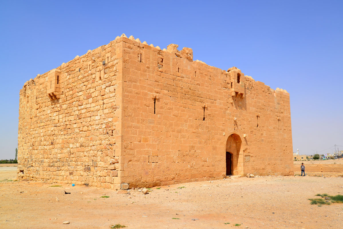
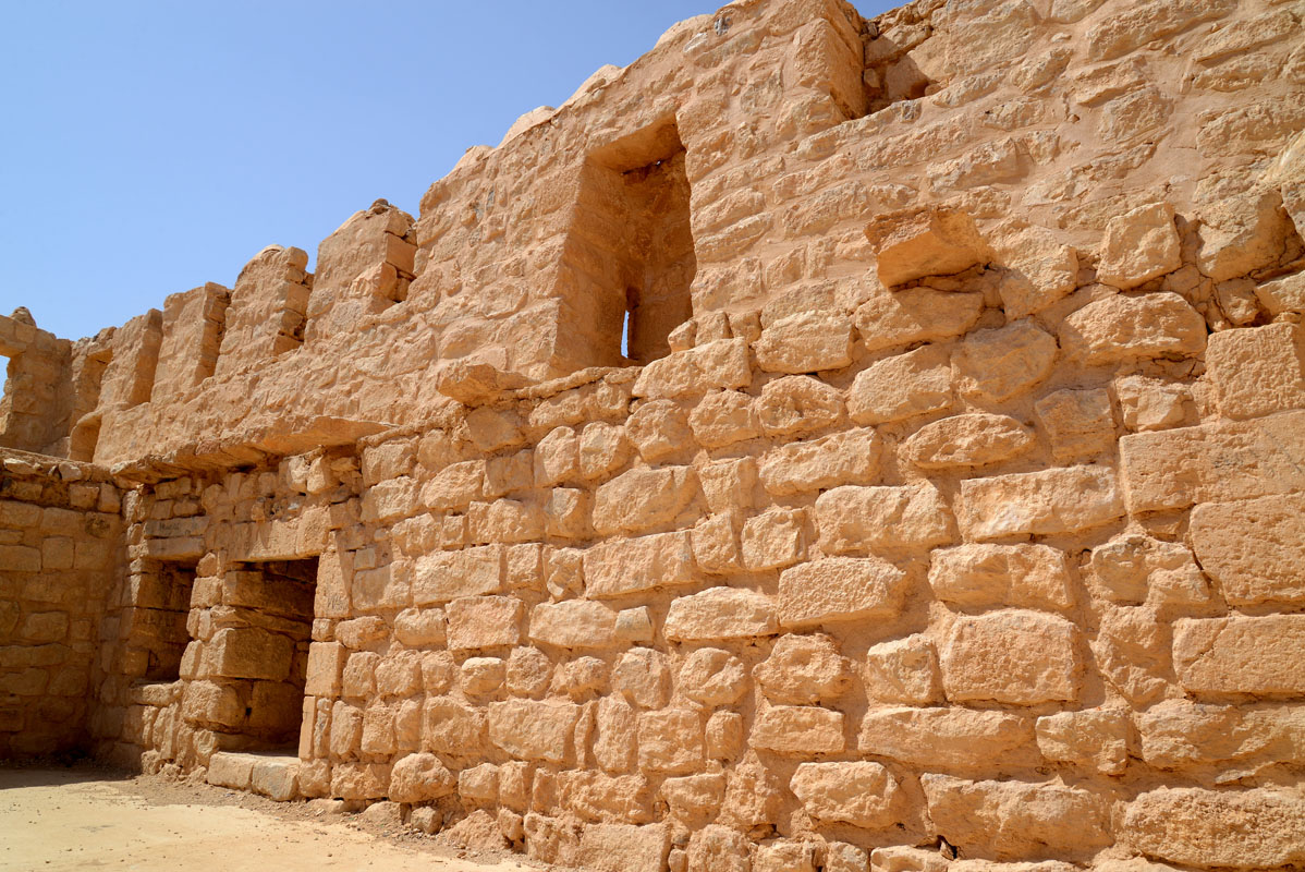
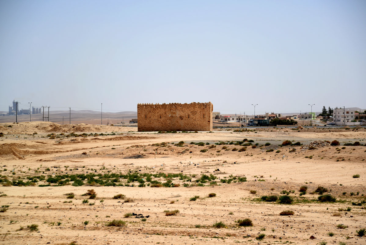
The fort is a tall (10 m high), rectangular structure, that stands 26 m to the west of the large reservoir and approximately the same distance from the banks of Wadi Hanifa. The south face of the fort, containing the entrance, is built entirely of ashlar limestone blocks, whilst the other sides are built of roughly square limestone blocks, with ashlars only used for the quoins. The top of the wall on each side is crowned with small, dome-shaped, crenelations made of stones covered in plaster.
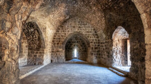
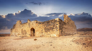
The gateway is, approximately, in the middle of the south side and is set within a shallow recess, covered by a horseshoe-shaped arch. The doorway itself is covered with a shallow segmental arch, made from three large, stone, blocks. There are two narrow slits, hidden within the arch covering the recess. The gateway opens into a square room with a flat roof, there is a pointed archway to the right, leading into a small passage, also with a flat roof made of basalt beams.
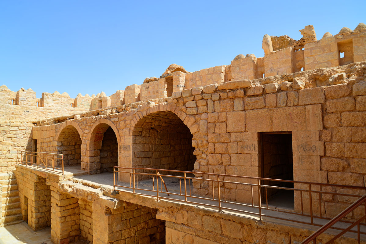
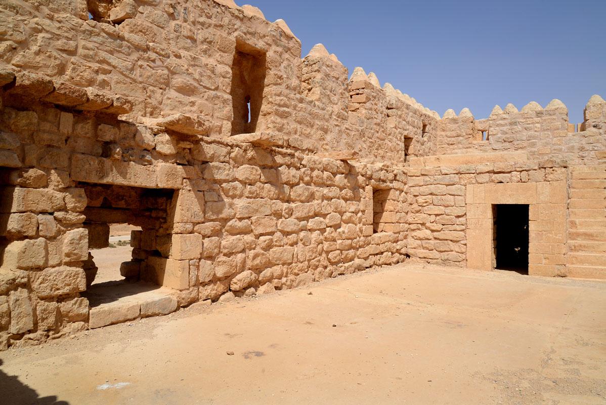
The courtyard is a narrow rectangle with a staircase at either end leading up to the first floor. In the centre of the west side, there is a square hole leading into a cistern. Eight rooms, including the entrance passage, lead off from the courtyard at ground level. All the doorways in the fort have the same design, comprising a plain rectangular opening covered with a stone lintel. To the right of the entrance, there is a small barrel-vaulted room and to the left, there is a narrow iwan with a roof made of basalt beams. In the southwest corner, there is a square barrel-vaulted room. On the north side of the courtyard, immediately opposite the entrance, there are two wide iwans, each roofed with a barrel vault and two square barrel-vaulted rooms, one at each corner.
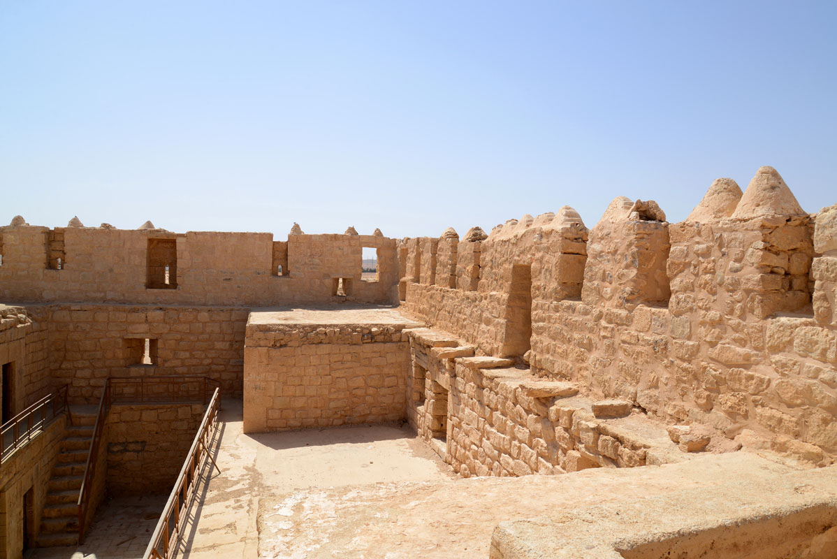
A staircase in the northeast corner gives access to the upper floor. This area contains no rooms; its main function appears to be to provide access to the parapet. On each side there is a box machicolation; each with two downward openings, the machicolation on the south side is distinguished by its dome-shaped roof and larger size. Flanking the machicolations there are a series of rectangular niches each containing a gun/arrow slit. At the west end of the south wall, between the southwest corner and the domed machicolation, there is a small, curved wall which rises higher than the crenelations and appears to be some form of enclosed vantage point.
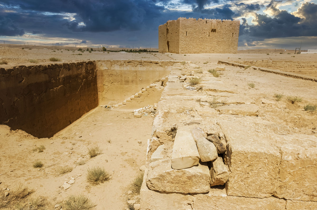
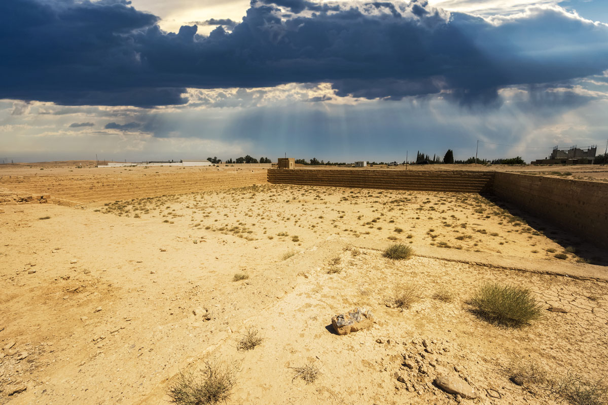
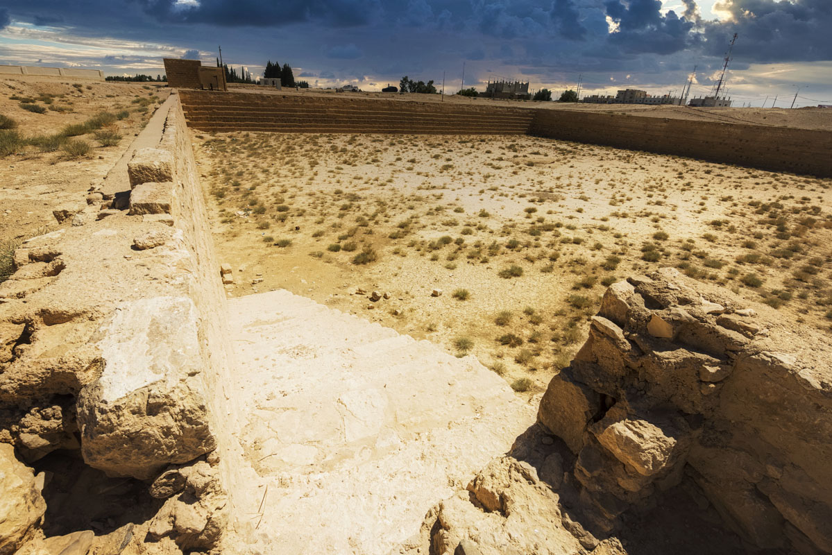
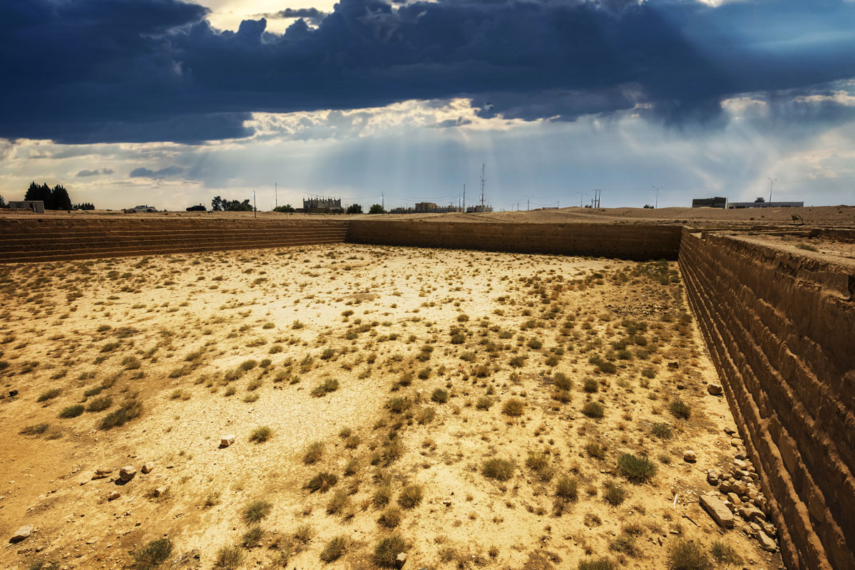
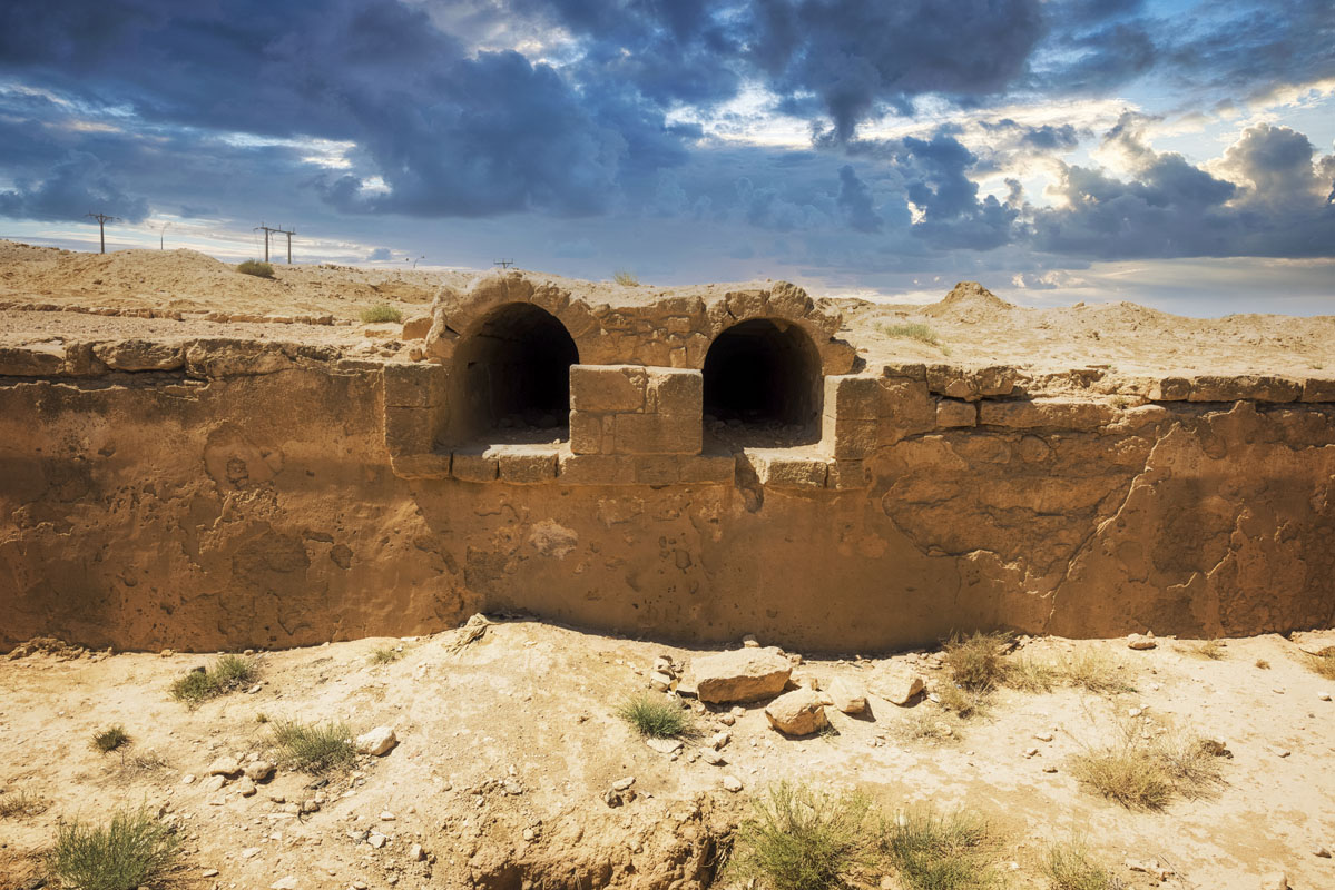
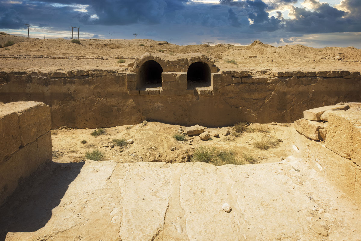
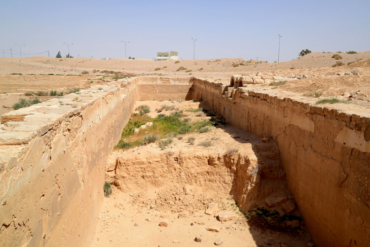
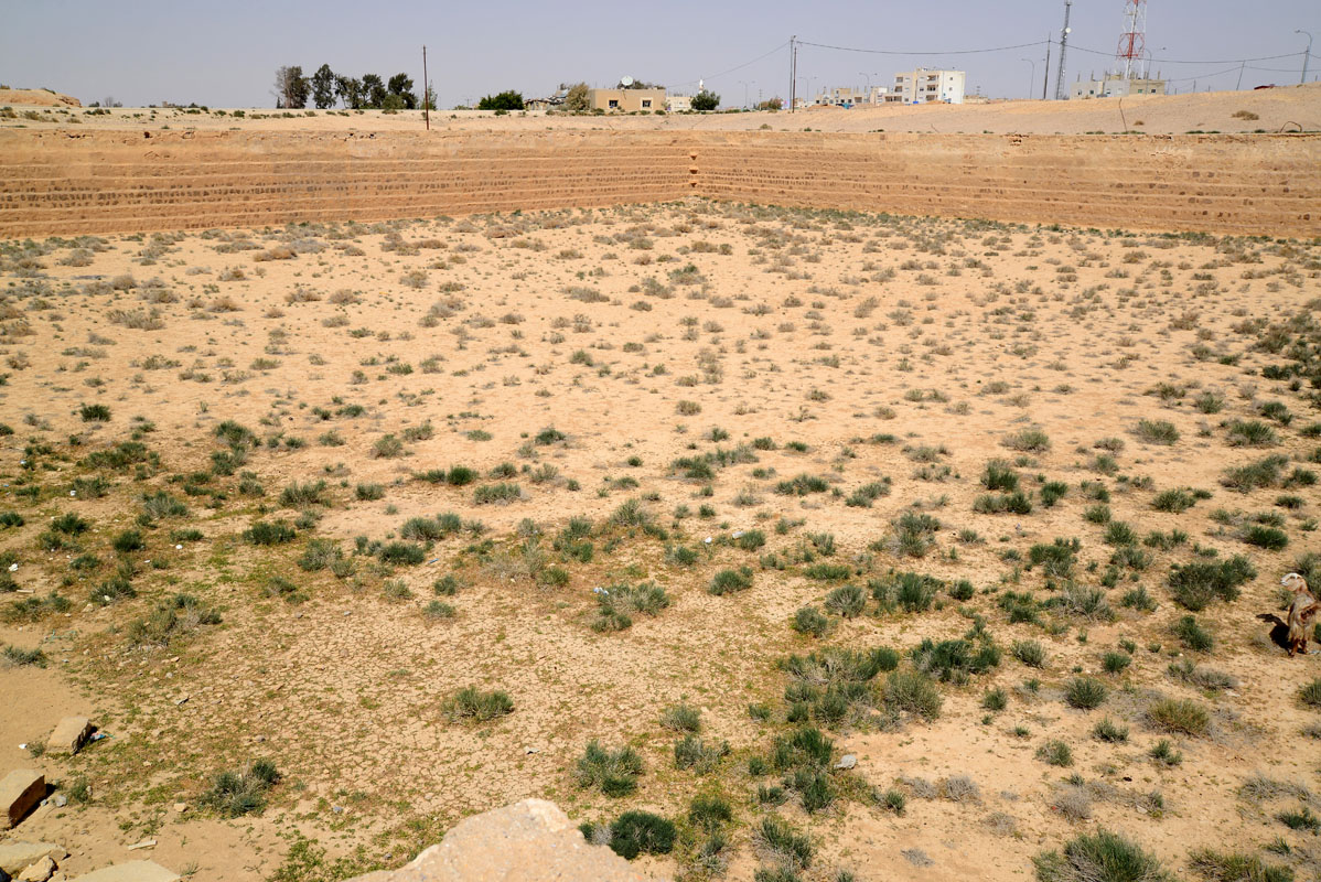
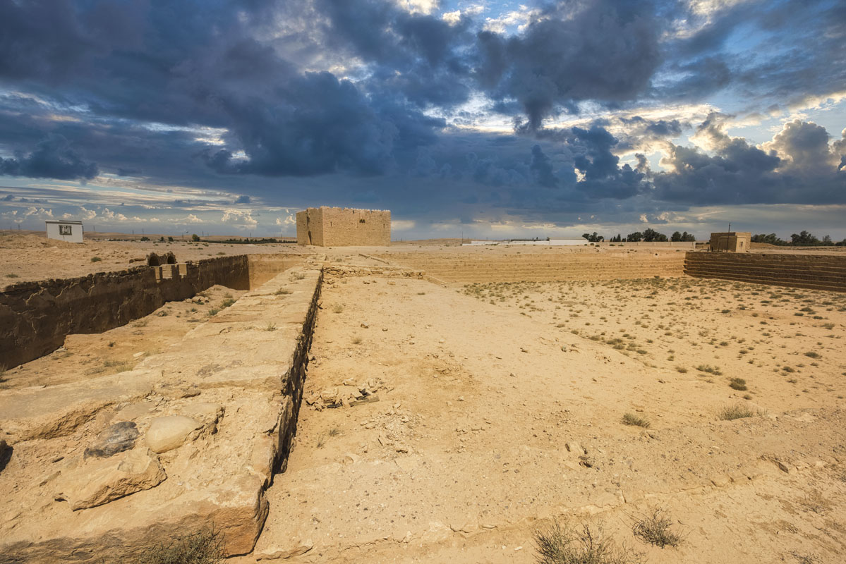
To the east of the fort, there are two reservoirs, a large square reservoir (69.5 m per side and 4 m+ deep) and a smaller rectangular basin (35.5 m 9.1 m and 3 m+ deep). Both are built of roughly dressed blocks of limestone and basalt. In the centre of the south side of the smaller cistern, there is an opening leading into two parallel vaulted channels. The channels run for a distance of 75 m, to a rectangular bridge-like construction connecting directly to the Wadi Hanifa. Although the water system has been in use in fairly recent times, it is probable that the two reservoirs, at least, are of earlier construction (Roman or Umayyad) as are the two channels connecting them. The bridge-like construction is, however, certainly of more recent construction and may be either early Ottoman or later.
Today Qal’at Qatrana could be easily reached from Amman via Desert Highway, however, due to the recent attempt to convert this site into a tourist attraction (a visitor centre, info-tabs, walking paths, etc), access to the fort is restricted. You can visit the site and see the fort from the outside, and explore water reservoirs but cannot go inside the fort, the door is locked.

This is an ancient site, with traces of Nabatean and early Roman occupation. The earliest mention of a building at the site is in the 1563 itinerary of Mustapha Pasha, where it is listed as Khan Qatrani. The fort was built on the orders of Sultan Sulayman, in 1559, as part of a building programme which also saw the construction of forts at, Ma‘an, Dhat al-Hajj and Tabuk.
The fort is mentioned for the first time in official Ottoman documents dated 1568, during the reign of Sultan Selim II. It appears the fort had been at the centre of disputes between local forces and the central government. The tribes in the area were in rebellion against Ottoman rule and relate an incident when the Hajj caravan, while in the vicinity of Qatrana, was attacked by 100 Bedouin horsemen. He also notes that the troops in the fort sold goods to the pilgrims for a good profit, but that he got provisions much cheaper by going direct to Kerak, two hours to the west.
In 1753 the Bedouin refused to allow the pilgrims safe passage until they were paid the subsidies and arrears, they believed due to them. The Hajj commander reluctantly gave in to the Bedouin and paid them the money. However, the Ottoman government perceived this as a rebellion and had all the tribal leaders executed. This enraged the Bedouin tribes and in 1756 there was a massive attack on the caravan at Qatrana. The Turkish Governor, Abdullah Pasha, had to take refuge in the fort where he stayed for 15 days until the Bedouin had left with their plunder.
In the latter part of the 19th century, the fort was visited by several travellers including, Doughty, Gray Hill and Brünnow and von Domaszewski. In May 1928 the fort was visited by Eric Schroeder of the Field Museum, North Arabian Desert Expedition. Schroeder described it as ‘an Arab fortress standing in disrepair nearly a mile from the Hijaz Railway station’. He also noted the projecting turrets, which he compared with those of Qasr al-Azraq.


